Backpacking: Seven Devils’ Lower Cannon Lake
My father-in-law and his wife have been visiting us since last Wednesday. Before coming out, he had asked if we could go on a little male bonding trip into the backcountry for a night. So, I set about looking for a short and easy hike to a spectacular place. I figured he had probably never spent the night under the rocky peaks next to a glacial tarn, and the high lakes are also one of my favorite places to spend a night, but most of the lakes around here are either fairly strenuous hikes, long hikes, or take nearly all day to get to the trailhead. Stevens lake originally came to mind, but Erin thought that might be too steep, despite the short 2.5 mile hike in. So I kept looking around and found Loon Lake out of McCall, which isn’t really a high mountain tarn but a morain lake at the base of a glacially carved valley.
I was all set to go to McCall when the heat wave hit Idaho. It was over 90-degrees in Moscow, and not much cooler in McCall. So I thought about some place that was a bit higher up: the Seven Devils. The loop trail around the seven devils is on the easy side of moderate, and Cannon Lake is only 4 miles in from the trailhead. At 7000 feet, the temperatures were much cooler than anywhere else. Then I checked the weather and noticed a good chance of rain in the McCall area, but less of a chance at the Seven Devils.
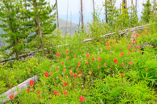
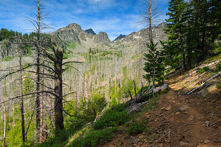
The trail to Cannon Lakes is short and sweet. It’s not difficult at all except for a few downed trees to navigate around. This is a beautiful walk around the east side of the Devils, descending through a lush forest of Mountain Hemlock and then traversing the mountainside through the burned forest, now on its way to recovery, but for now lined with lupine, paintbrush, and a variety of other wildflowers. The trail crosses a few creeks and at about 3 miles, meets up with the Cannon Lakes trail. From there, you ascend back up to 7000 feet over the next mile, traversing through beautiful flower-laden alpine meadows. The toughest part of the hike was the return trip, where we had to ascend about 1000 feet over the course of 1.5 miles back to the trailhead.
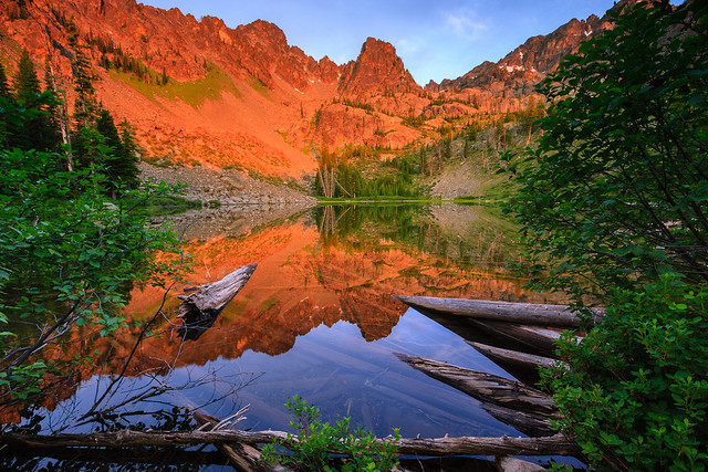
Cannon Lake sits in a basin between She Devil and Tower of Babel, both of which are visible from the trail, but disappear behind some closer formations as you approach the lake. The peaks tower over 2000 feet and really instill a sense of awe. Because we were on the west side of the range, the sunset was fairly lackluster, but sunrise was spectacular. The high peaks receive the first light of the day and are quickly bathed in the pink alpenglow of the sun emerging from the horizon. Normally, I’d be up to witness the first light on the peaks, but on this trip, I slept in, woken up only by my father-in-law who beat me to the morning view. Luckily, I rushed out of the tent just in time to catch the whole face bathed in pink before the color completely faded.
Friday’s hike in was on a very hazy and muggy day. The air was cooler up on the mountain, but the view was almost nonexistent. You could barely make out the mountain peaks across the Salmon River canyon. Despite the threat of thunderstorms, we had a clear night with blue skies and sunshine the next morning. The haze had thinned out on Saturday and the temperatures dropped a bit never exceeding 70. It was the perfect hiking condition.
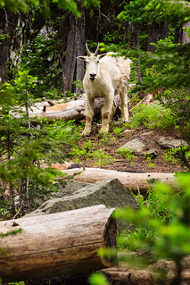
When we returned to the car, I decided to show him the campground, and it’s a good thing we did. A mountain goat was hanging around one of the campsites. I then took him up to the Heaven’s Gate Lookout to get him over 8000 feet and get a view of Hells Canyon. Our stay at the tower was cut short by an approaching thunder storm that we watched approch over the high peaks. I’d say we timed this trip perfectly. The rain hit as we started our descent back into Riggins.
There’s one precaution to take when hiking into the high country this time of year. I had underestimated the course of mosquito season, and it seems we had hit the motherload. I also made the mistake of dismissing the need for bug spray. I generally don’t use it because I hate putting chemicals on me and introducing them into the environment. But given how bad the mosquitoes were, I’m willing to reconsider.