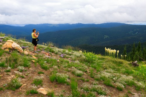
Steptoe Butte and the Palouse

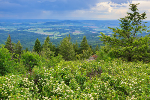
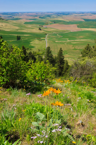
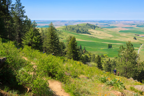
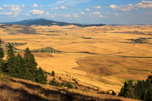
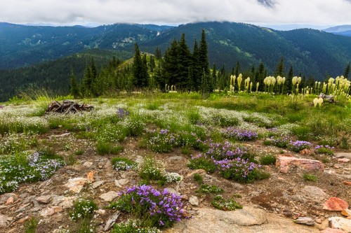
When I moved to the Palouse, I didn’t realize just how photogenic the landscape was. Then I saw ads for the Palouse in Popular Photography. It turns out, people will pay good money to come and photograph the region, and here I am living there not taking advantage of my home turf. I’ve only been on Steptoe Butte once before, and it was in the winter with not much snow on the ground. So I was quite glad when Simon came back to visit and suggested we go out and shoot the Palouse. We hit Steptoe Butte at the right time while it was covered with balsamroot and lupine, and the fields of the Palouse alternate between the green of new wheat and brown of a freshly plowed field. Simon also came with an arsenal of lenses that we shared. I knew I needed to get a nice long lens, but now I really know how much a long lens can complement landscape photography.

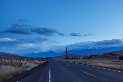
Steptoe Butte and a country road.

Steptoe Butte and a country road.

Steptoe Butte rises behind a Palouse farm.

Steptoe Butte rises behind a Palouse farm.

Arrowleaf Balsamroot

Arrowleaf Balsamroot

A sea of green.

A sea of green.

Plowing fields.

Plowing fields.

Balsamroot over the Palouse

Balsamroot over the Palouse

The small town of Steptoe among the hills.

The small town of Steptoe among the hills.

The fading sun captures the dust of farmers tilling their fields.

The fading sun captures the dust of farmers tilling their fields.

There's not much native prairie left on the Palouse.

There’s not much native prairie left on the Palouse.

Contrasts and patterns of the Palouse.

Contrasts and patterns of the Palouse.

We had hoped for a sunset, but this is the best we got.

We had hoped for a sunset, but this is the best we got.

We came across this moose on the way down. It made up for the lack of a sunset.

We came across this moose on the way down. It made up for the lack of a sunset.

Good sunsets often occur after a day of rain and storms. The following Saturday, scattered rain storms swept through the area. I was in Moscow with Erin and Clara at the annual renaissance faire, which is more like an arts festival than a true renaissance festival. As evening approached, I noticed an end to the rain on the horizon to the west. I checked the radar and Steptoe Butte was clear. So we headed back up so I could show Erin the beauty of the floral displays, and to capture the sunset over the Palouse. It wasn’t quite as vivid as I wanted, but I got some color in the clouds and it was much better than the sunset on my previous visit.

Rains in the distance over the Palouse

Rains in the distance over the Palouse

Field of Lupine

Field of Lupine

Lupine on Steptoe Butte

Lupine on Steptoe Butte

Sunset on Steptoe Butte

Sunset on Steptoe Butte

Sunset on Steptoe Butte

Sunset from the lupine field on Steptoe Butte.

Sunset from the lupine field on Steptoe Butte.

Pink clouds as the sun sets.

Pink clouds as the sun sets.


Posted in Photo Blog | Leave a comment

White Pine Loop & Bomber Too

Last week, Clara and I had a day to ourselves, so we had a little adventure on a nearby trail. The white pine loop is a 3-mile hike from the White Pine campground off of Idaho Rt. 6. A one-mile (one-way) out and back spur takes us to the site of a WWII bomber crash site with some pieces of the wreckage still littered throughout the woods. But rather than write a lengthy post with a few photos, I’ve decided to try a video series that I’m calling Adventures with Clara to highlight just how adventurous she is.


[map style=”width: auto; height:400px; margin:20px 0px 20px 0px; border: 1px solid black;” gpx=”http://www.mineral2.com/wp-content/uploads/White pine loop hike.GPX”]
Posted in Hikes | Leave a comment

Canoeing on the Palouse River

March is such a bipolar month in Idaho. One day it can be cold and snowy and the next can be sunny and 60. So while we had cold rain during the weekend of our canoe trip, this past weekend was really nice. I took Clara out for a hike on the Potlatch River Trail near our house and she hiked almost two miles on her own feet. And because this week was spring break at the university, we still had our canoes from last weekend and went out for a day trip on the Palouse River on Sunday. It was such a nice day that we weren’t the only ones with this idea. There was another group behind us, but they only paddled half the stretch we did.

For most of the year, the Palouse River doesn’t have enough water to carry a canoe. But during the early spring, the flow is up enough to flow all the way from Laird Park to the confluence with the Snake River, portaging around the falls of course. On Sunday, we paddled 16 miles from the town of Palouse to the ghost town of Elberton. In some ways, this trip was much better than the lower St. Joe. It was sunny and warm out and the river isn’t flanked by a major road or vacation homes. That last part provides a sense of isolation and solitude that’s missing along the lower Joe. But the wildlife wasn’t quite as good on this trip. We saw one Bald Eagle, and that was from the car driving back to Palouse. There was a small herd of deer that ran across the river and some songbirds.

This stretch of river is fairly easy and great for beginners. Though there are a few rocks hiding beneath the surface, there are no major rapids and the water is fairly shallow. It’s too bad that the river gets so low during the summer as this would be a great little trip to repeat with the family. On Sunday, we paddled 16 miles in 3 hours. Total trip time was 3 hours 45 minutes with a stop for lunch. I’d love to do some more long distance canoeing while I’m out here. If only I didn’t have a dissertation to write…

Posted in Travel Stories | Leave a comment

Canoeing the St. Joe

Hello.

I realize it’s been quite some time since my last post. That’s what happens when you get into dissertation writing mode. Life tends to cease and all you can think about is finishing this damn thesis. As a result, I haven’t really been on many adventures since December, nor has there been anything interesting to write about, nor have I had time to really write about anything, so I’m taking a short break to write about my most recent adventure.

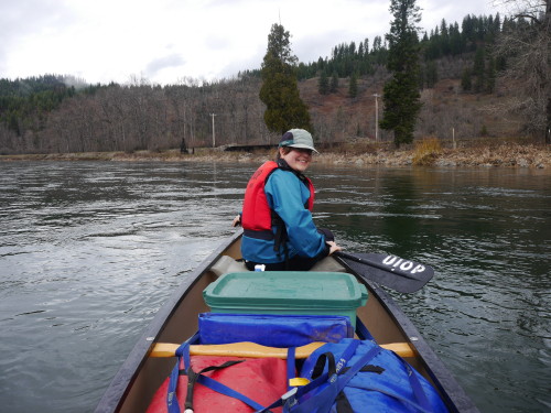
It’s Spring Break at the University of Idaho, and while some students are headed south for warmer weather, others headed into the mountains for some end of season snow. Meanwhile, a small group of us headed out to the St. Joe River to canoe 34 miles in the cold and rain. Our adventure begins at the Huckleberry Campground, about 12 river miles downstream of Avery. We pulled in Friday night after dining and drinking with the locals in St. Maries. We parked a car in town and took two more with us to the campground, one a giant van with two boats on top, the other my Forester with the third boat. We slept in the cars to avoid packing up wet tents, though we brought an extra tent to help with space. Though it rained through the night, we were lucky to wake up to a (relatively) dry morning.

Packing our bags and getting ready for the float. Photo by Thibault Stalder

Packing our bags and getting ready for the float. Photo by Thibault Stalder

The canoes all packed up and ready to go. Photo by Thibault Stalder

The canoes all packed up and ready to go. Photo by Thibault Stalder

On the River! Photo by Thibault Stalder

On the River!
Photo by Thibault Stalder

I feel that we were quite lucky on this trip. The weather forecast originally called for rain all day on Saturday, but when we pushed off, there wasn’t a drop from the sky. We even saw some blue overhead during the morning. The water was flowing fast, and we started off pushing almost eight miles an hour, but that pace didn’t last long. It took us about an hour to reach Caulder six miles down the river. We managed to keep up that pace for the next seven miles where we pulled off for lunch. After that, things slowed down. The river deepens and slows to a near halt as the water level approaches that of Lake Coeur d’Alene where the river empties many miles past St. Maries. The last few miles of the day were spent paddling flat water. Despite some gusts of wind nearly blowing us backward, we made eight and a half miles in two hours. In total, we paddled 21.8 miles in four hours, not including the hour and a half lunch break.

As mentioned earlier, we had great weather during the first half of the day. But while we were stopped for lunch, we were hit with a short rain shower. Luckily it blew past and we headed back on the river with hopes for a dry trip. But it didn’t last long. We had hit the flat water and were about three miles from camp when the storm hit for good. I’m thankful that my rain pants were still waterproof after all these years. My rain jacket was still doing ok, but started to get damp on the inside. I suppose even Gore-tex doesn’t last forever. We stopped for the night at the Shadowy St. Joe campground, which was technically closed for the season, but the Forest Service told us that nobody would kick us out.

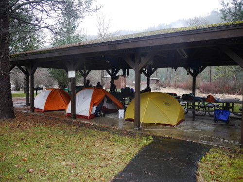
Because of the rainy forecast, we had packed tarps to hang at the campground so we could set up our tents without getting them wet on the inside. We were quite relieved to find a large picnic shelter at the campground. There was ample room to unpack our bags and set up our tents. In the end, we slept under the shelter. Wesley and Thibault then hitched a ride to our starting point to bring the cars closer, reducing the shuttle time when we finished. It was also to retrieve some items left in the car that we needed for dinner. The rain did let up around 5:00 and we were able to build a fire in the fire pit to cook burgers. But for a while, we were looking at the possibility of a cold and wet evening. In the morning, we awoke to clear blue skies and sunshine, which is what we expected from the weather forecast. That gave us a bit of warmth and optimism for the day’s trek.

Camping under the picnic shelter at Shadowy St. Joe campground.

Camping under the picnic shelter at Shadowy St. Joe campground. Photo by Thibault Stalder

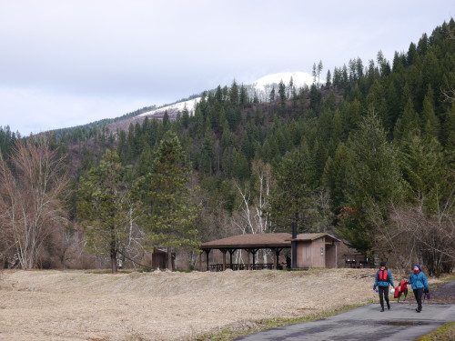
Since we had the cars parked outside the campground, we were able to leave most of our gear behind which made packing up and preparing the canoes a little easier. We pushed off and paddled 12.8 miles of flat water to the town of St. Maries. St. Joe Baldy rose above the river showing off its bright white summit. There seemed to be enough snow to ski up there. Unlike Saturday’s fast pace, we averaged a little under four miles an hour and completed the entire stretch in three and a half hours. Again, the rain returned as we were only a few miles away from our take-out, but it was enough to soak us. On such a rainy day, there weren’t many people out at the river park in town, so we left the canoes and warmed up in a nearby coffee shop. The rain stopped as we headed out to retrieve the other cars, but we sure timed our departure quite well. As I was leaving St. Maries, I drove into the middle of an intense thunder and hail storm. I was not expecting that this time of year.

St. Joe Baldy (elevation ~5800 feet) rises above our camp.

St. Joe Baldy (elevation ~5800 feet) rises above our camp.  Photo by Thibault Stalder

In total, we paddled 34 miles in 8 hours, excluding breaks. I would never have thought to plan a canoe trip in March, but it worked and we had a great time. In the map above, day 1 is shown in pink and day 2 in purple.


Posted in Travel Stories | Leave a comment

Merry Holidays!

I had a good Christmas this year. It began with a week of continuous snow fall. We’d have 3-6 inches here and there with warm days compacting the wet and heavy accumulation. But all of that still adds up so that by the time Christmas rolled around, the snow was over a foot deep in parts of our yard. Meanwhile the mountains have been getting hammered. Moscow Mountain has over 40 inches in the upper elevations, Brundage has over 90 inches at the summit, and I’m not sure of the current depths at Freezeout and Lolo Pass as the snotels have stopped reporting for the moment. As it stands, we’ve already had more snow on the ground than the entirety of last winter.

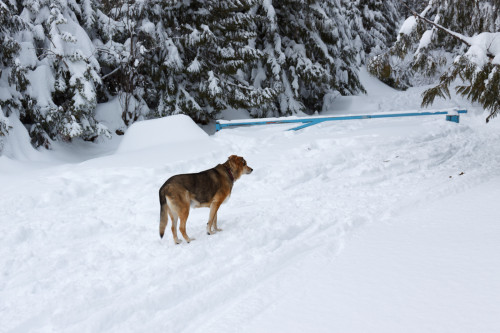
Yesterday, we went out for a snowshoe hike on Moscow Mountain. We only hiked a mile up Tamarack Road before Clara got cold, but the conditions were perfect for walking on the mountain. Lower temperatures meant a drier, fluffier snow pack and previous skiers had already packed a surface so that we weren’t breaking a new trail. I’m not sure how deep the snow was where we were, but it was at least 2 feet as my poles could sink that far into the powder. The surface was just a few inches below the gate.

Greta on the trail

Greta on the trail.

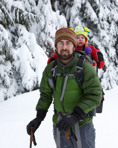
Clara enjoyed the hike from her backpack seat.

Clara enjoyed the hike from her backpack seat.

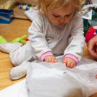
Christmas itself was quite enjoyable. Last year, Clara was too young to really appreciate presents. This year, she really enjoyed ripping off the wrapping and playing with her new toys. She got some crayons and markers, some books, a shopping cart, a baby doll (which she loves), a play kitchen, and a tea set. Here are some photos of Clara opening and enjoying her gifts.

Posted in Personal Updates | Leave a comment

5000 feet

It snowed in Moscow for the first time this season on Thursday. And although the accumulation didn’t amount to much in town, the mountains were turned white the next day. But two days of sunshine, and evidence of the snow is all but gone. The mountains around Moscow are back to their baren self. But at 5000 feet, winter has begun. Today I drove up to the Bald Mountain lookout tower on Palouse Divide, mostly to find a geocache, but also to enjoy the view, hike in the forest, and see just how much snow may have fallen at higher elevations. It turns out the answer is a lot, but not really that much.

Snow on the road

The road up to Bald Mountain.

As I neared the summit, the road suddenly became blanketed in a couple inches of snow. It’s nothing I couldn’t handle, and someone had been up there before me leaving tracks for me to follow, but it was enough to cause some concern without snow tires on the car. I did make it up and back just fine and in time to enjoy some late afternoon views before the sun set and the clouds covered the sky. The last mile to the summit was surreal. There was even snow on the trees giving the impression that winter had freshly settled upon the mountain top. In the distance, higher peaks were covered in snow as well. And though it was a blistering warm 50-degree day in town, temperatures at the tower were only a few degrees above freezing. This is Fall in the northwest. Instead of bright colors on the trees, we slowly watch winter descend down the mountains to engulf the whole area. Maybe this year we’ll actually get a proper snowfall.

IMG_7522

Posted in Personal Updates | Leave a comment

Elk Creek Falls

I think I’ve mentioned Elk Creek Falls in passing, but haven’t actually written a featured post about it. Elk River is a small outdoor recreation town (read: hunting & fishing mostly) a little over an hour east of Moscow. This small community represents the “end of the road.” The paved road ends here and forest service roads pick up to take you into some remote places. While most people come back here to hunt, ride ATVs and snowmobile in the winter, there are some family-friendly hikes and other attractions that make Elk River worth a visit. There’s the giant cedar, the largest tree east of the cascades, as well as a second old-growth cedar grove. There is Elk Butte, which is less of an official hike and more of a walk along gated roads to a high lookout tower 3000 feet above the town. There’s the general store in town, which serves its own huckleberry ice cream, a treat of itself. And then there are the falls.

Despite there being an abundance of mountains in Idaho, the state is relatively sparse in waterfalls compared with its western neighbors of Oregon and Washington. Elk Creek Falls is therefore something of a rarity for north Idaho. With the three cascades combined, it’s the tallest waterfall in the northern part of the state. To view all three falls, you hike a 3-mile loop of moderate difficulty. The upper falls is the smallest of the three, dropping about 20 feet into a deep pool accessible by the trail. This becomes a popular swimming hole on the hottest days of the summer. The middle falls are the tallest drop at about 70 feet, but this is viewed at a distance. While the lower falls is shorter, about 50 feet, it’s possibly the grandest of them all. The water plunges over some basalt columns into a steep-walled gorge before heading out toward the Dworshak Reservoir.

The hike takes you through some protected patches of forest where you can find a variety of plant and animal life. It’s a great place to find wildflowers in the spring and watch birds all summer long. The trailhead has a picnic area with 4 tables and a privy. The observation areas at each falls has a bench to sit on while enjoying the view. Expect to spend at least two hours here if you take the full hike. Fortunately, there are connector trails which allow you to pick and choose which falls to see if you don’t want to visit all of them.

Here’s a video tour of our most recent hike to the falls with Clara.

[map style=”width: auto; height:400px; margin:20px 0px 20px 0px; border: 1px solid black;” gpx=”http://www.mineral2.com/wp-content/uploads/Elk creek falls Hike.GPX”]
Posted in Personal Updates | Leave a comment

Latah County Fair

Clara loves animals. At home, she loves to pet the dogs and the cats. She tries to pet the chickens and gets all excited when we catch one and bring it over to her. She loves saying hi to the goats and touching the horses. So we brought her to the Latah County Fair where she could look at and touch a whole host of other animals that we don’t have on our property. But rather than write about this, I thought I’d change things up and record this account on video.

Posted in Personal Updates | Leave a comment

Seattle

In the 5 years living out here, I haven’t been to Seattle other than to catch the ferry over to the Olympic Peninsula. So when four of my college buddies from Drew mentioned they were converging in the city for a race in September, I jumped at the opportunity to pay a visit. So for a weekend in September (11-13), we loaded up the car and headed westward for a few days.

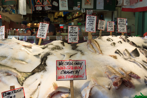
Pike Place

Although Seattle is “the big city” around here, it’s nowhere near as big and daunting as some of the truly big cities of the world. Downtown is only several blocks long and several blocks wide and after that, the tall skyscrapers give way to smaller neighborhoods with a mix of historic and modern architecture. I would consider Seattle to be a neighborhood city, and that’s where its charm lies, as part of the reason to visit Seattle is to experience the local culture. For example, we spent a day in Fremont, one of the neighborhoods just north of the city. Fremont has a small town main street feel with local shops and restaurants lining the streets. I would describe the neighborhood as progressive. Then again, that explains most of the Seattle area.

We were in Fremont because that’s where Geocaching.com has its headquarters, and I really wanted to take the opportunity to visit. So after spending some time at the zoo, we went to geocaching to find their headquarters cache. Afterward, we had dinner at an excellent Thai restaurant and then I dropped Erin off at a gluten-free and vegan bakery so that she could get some homework done. Meanwhile, I walked around the neighborhood with Clara to explore and find some geocaches.

Clara at the Seattle Zoo

Clara at the Seattle Zoo

As I mentioned above, we took Clara to the zoo. It turned out to be a mild success. She was mostly interested in other people and the texture of the walkways. But occasionally we would come across an animal that she liked. One of the tigers was lounging in front of the glass and she thought that was pretty cool, and she briefly enjoyed the jaguar. But mostly she was interested in animals swimming underwater. We had hope that the aquarium would be more successful.

Clara at the Aquarium.

Clara at the Aquarium

The next day, we headed downtown to the aquarium. Seattle’s aquarium is quite small compared to, say, Baltimore’s, but it’s very nicely done. Like the Alaska SeaLife center, the Seattle aquarium focuses on mostly native life of the pacific northwest, with one section featuring tropical Pacific life, mostly from the Hawaiian islands. There’s the giant Window on Washington tank, featuring salmon in their ocean stage and other large fish from the coastal shelf. The next exhibit features some tide pool touch tanks with coastal invertebrates. Next come the tropical exhibits. Then we move outside where there are some shore birds and mammals and the underwater dome featuring life from the Puget Sound. Clara loved the aquarium as we expected.

Once we were done with the fish, we headed up to Pike Place market to check out the shops. This is like a full-time farmer’s market with fresh meat, fish, and fruit & veggie stands, plus a few restaurants and other artisan food shops. The lower levels are like a shopping mall, but the stores are locally owned shops instead of corporate chains. It’s both touristy and a legitimate local shopping hub.

Pike Place

On Sunday, we went to the REI flagship store before heading home. I was expecting some special experience similar to L.L. Bean’s flagship store. Unfortunately, it was just an oversized REI store with the only extra bit being a kid’s play space, which Clara enjoyed, and an overpriced cafe. That’s not to say it isn’t worth visiting. The grounds outside are beautiful and the store is huge. But don’t expect to find anything that you wouldn’t otherwise find in your local REI store.

I would like to explore Seattle some more. Two and a half days is just not enough to see every place and do everything. And that’s just in the city. There is much more to explore in the mountains just outside the city as well as the islands in the Puget Sound and the Olympic Peninsula.

Spectacular sunset on the flat plains of central Washington.

Spectacular sunset on the flat plains of central Washington.

Posted in Travel Stories | Leave a comment

Wallowas Weekend 2015

After a long summer with not much exploring, the pace has changed and I’ve had a fairly busy two weeks. The series begins with the return of the Annual Wallowas Weekend. In the six Septembers that I have lived here, I’ve led a backpacking trip to the Eagle Cap Wilderness four of those years, with this year being the fourth. Each time I bring someone new, and each time we explore new trails. This is the first year that we didn’t spend a night at Mirror Lake and the first year that Tyler didn’t join us. Instead, Wesley returns for a second year to help me lead six newcomers to these mountains. Amanda, John, Ian, and Mason are new graduate students to the Biology Department. Josef is a post-doc and his girlfriend Laura also joined us on this hike. Thibault has been to the Wallowas before, but not on one of my Wallowas Weekends. So there we were, a fellowship of nine misfits charged with the task of ensuring that the ring of pow…

Oh right. Sometimes when I’m hiking in the Wallowas, it’s hard not to imagine that we’re crossing the Misty Mountains, and the weather this year just added to that effect.

This year we hiked 11 miles over two days. If that doesn’t sound impressive, it’s because it’s not. I wanted a relatively easy and painless hike to make up for the past few backpacking trips that turned out to be way more strenuous than anticipated. And the weather kinda cut our trip down from three days of hiking to two. In fact, we almost didn’t go to the Wallowas at all. After our hike in the Seven Devils, fire season hit hard and heavy. It was one of the worst seasons on record, which is mostly why the summer has been devoid of travel and exploration. For over a month, the visibility and air quality in Moscow was abysmal, and those conditions extended beyond our region. Much of the smoke had come from some large fires along the northern California coast. But depending on which way the wind was blowing, the smoke could have also come from fires in north-central Washington, or a large fire very nearby to the east in Kamiah. In addition to the smoke, small fires dotted the forest up and down the state, leaving very few places safe for hiking. Once place that was spared the wrath of fires, near and far, was the Sawtooths. So a week before our planned outing, we met and decided that the Sawtooths would be a better alternative for this year’s adventure.

Then the weather changed. Cold fronts blew in and dampened the area. Winds blew the smoke out, temperatures dropped, and the air cleared. For the whole week, the smoke did not return, but we still had our hearts set on the Sawtooths. Despite the longer drive, we picked out a nice 3-day loop to explore some mountains that none of us had been to before. While the smoke conditions had improved, the overall weather had not. Instead of hot and dry conditions, we had cold rain in the forecast. In fact, it was to rain from Friday evening through Saturday night, and in the mountains, that rain was to fall as snow. I’ve camped in the cold and hiked in the rain, but we had no interest in camping and hiking in the cold and the wet. With Saturday’s high predicted to remain under 50º, we decided to cut our hiking down to Sunday and Monday of the holiday weekend. Both days were to be cooler than average, but at least the sun would be out. And since we didn’t feel it was worth driving seven hours to hike two days, we moved the hike back to the Wallowas where we would enjoy an evening of beer and food at Terminal Gravity the night before and camp on their lawn. And so we arrived in Enterprise on Saturday night just in time to see what the passing storm had done to the mountains.

A storm had dropped the first snow on the Wallowas the day before our backpacking trip.

A storm had dropped the first snow on the Wallowas the day before our backpacking trip.

Josef and Laura were to meet us in Enterprise Sunday morning. While we waited, we decided on a trail – a decision between hiking Two Pan to Mirror Lake as I did my first year, or hike into Dollar Lake at the base of Aneroid Mountain from the Tenderfoot trailhead. We eventually settled upon the second choice under the guise that none of us had been on that trail before and therefore we were all experiencing something new together. Josef and Laura were running late, so we agreed to meet them at our campsite at Dollar Lake instead.

The Tenderfoot trailhead lies at the end of a short rough road along the eastern side of the mountains. At 6500 feet, it’s one of the higher access points to the wilderness area. It’s a 5.5 mile hike to Dollar Lake with a continuous, but gentle climb of 2000 feet. This even grade makes for a nice easy hike. From the beginning, the terrain is gorgeous, but very different from the central valleys that we are used to. For one, the valley is not as deep as the Wallowa, Hurricane, or Lostine valleys, and the mountains are concocted of layers of basalt and shale rather than granite. This difference in underlying terrain meant the floral community was different as well. We passed by some sagebrush communities and aspen groves in the first section of the hike.

Hiking in on the Tenderfoot Wagon Road

Hiking in on the Tenderfoot Wagon Road

We began on the Tenderfoot Wagon Road for about two miles before turning off onto the Bonny Lakes Trail which passes by the Bonny Lakes and ascends the pass to Dollar Lake. We had a leisurely hike in the sun, stopping frequently to rest and enjoy the view. We ate lunch at one of the Bonny Lakes and then trudged onward, our destination less than a mile ahead. As we neared the top, it became clear that not much snow had fallen, and that it just looked worse from below. Much of the snow had melted through the course of the day. When we made it to Dollar Lake, the sun was still shining down upon us, and we took some time to set up camp and rest a bit.

IMG_7173 IMG_7175 IMG_7186IMG_7191IMG_7195

With such a short hike, we had planned to drop our packs and head for the summit of Aneroid Mountain another thousand feet up. Aneroid is not a hard mountain to climb. It’s practically a walk up the slope to the summit with a short rock scramble at the top. Of course, with all mountains, the route looks easier from below than when you’re actually on it. The slope was steep – not as steep as the scree fields at the Seven Devils – but it was still a workout to ascend. When we started our ascent, the sun was still shining. There were clouds amassing over the peaks to the south, but otherwise still looked like a clear day.

IMG_7196

Climbing Aneroid Mountain

Climbing Aneroid Mountain

During the first half of the climb, we had an open forest of short trees for support. When we rose above the treeline, we were already above 9000 feet. But by that time, I had noticed the mountains to the west disappearing one by one into a storm. I called out to those ahead of me to reconsider our plan. Finally, when all but the adjacent ridge had disappeared, they decided to turn back. With no way of gauging just how bad this storm could be, I was not going to take any chances with bad weather on a mountain summit. We descended with snowflakes falling upon us.

Approaching Storm

Approaching Storm

Getting closer...

Getting closer…

and closer...

and closer…

Descending Aneroid

Descending Aneroid

Back at camp, we waited out the storm. Josef and Laura had arrived and were exploring while waiting for our return. It turned out that the storm was small and passed over us rather quickly. But some other hikers coming off the mountain reported some strong gusts that reaffirmed our decision to turn back. Unable to build a fire, we huddled in a small clump of trees for warmth and snacked on cheese and wine before breaking out the stoves for a dinner of mac and cheese. The winds kicked back up and the snow returned as we performed the bare minimum of clean-up and retreated to the shelter of our tents for the evening. The wind gusts blew strong through the night, but our tents held firm. We had the fly tied down to rocks because the ground was too hard to put stakes in. A few times I found myself pulling out the vestibule only to have it blow back into the tent. Luckily the storm was mostly wind and little precipitation. Still, it was cold and I was the most uncomfortable I’ve ever been on a backpacking trip. I think I need a new sleeping bag as mine doesn’t seem to stay as warm as it used to. Also, I might want a new sleeping pad for better cushion.

Exploring Dollar Lake

Exploring Dollar Lake


When I backpack, I tend to bring extra weight. I carry a big DSLR with two lenses and a tripod. This allows me to capture the spectacular images that accompany these posts. The tripod is specifically for sunset and sunrise at the lakes. Without it, I’d get get blurry images due to the long exposures needed at such low light. With the storm Sunday night, I was afraid I had lugged the tripod up for nothing. I awoke Monday morning to calmness. I fixed the vestibule and then unzipped the tent to gauge the conditions: clear blue sky. With that, I got out and prepared to shoot the coming sunrise. Not only that, but others were awake too, and when I summoned them, they came. It was the first time I had company for a sunrise.

Pre-dawn at Dollar Lake.

Pre-dawn at Dollar Lake.

Sunrise and the Wallowa River Valley

Sunrise and the Wallowa River Valley

Alpenglow on Pete's Point

Alpenglow on Pete’s Point

Morning Light

Our camp with the ridge behind it.

Our camp with the ridge behind it.

The morning was cold, but worth the effort. Most everyone decided to climb the ridge behind camp to watch the sun rise. I stayed down below mostly because I didn’t feel like exerting the energy to get up there. The light quickly descended and warmed us up as we made breakfast and coffee and packed up our gear. We left at 9:30 and headed back the way we came. Monday was sunnier and warmer than Sunday. The remaining snow was quickly melting away as we hiked down into the valley. I stopped for a couple of reflection shots on the glassy mirror-like surface of Bonny Lake. Otherwise, we made good time, getting back to the car shortly after noon. We finished the weekend with our traditional beer and burger at Terminal Gravity.

Pete's Point rises high behind Dollar Lake

Pete’s Point rises high behind Dollar Lake

Hiking back across the alpine meadow beneath Aneroid Mountain.

Hiking back across the alpine meadow beneath Aneroid Mountain.

Reflections in the Bonny Lakes

Reflections in the Bonny Lakes

Packs

Victory shot at the end of a successful trip.

Victory shot at the end of a successful trip.

[map style=”width: auto; height:400px; margin:20px 0px 20px 0px; border: 1px solid black;” gpx=”http://www.mineral2.com/wp-content/uploads/Wallowas 2015.GPX”]
Posted in Hikes | Leave a comment

Seven Devils on the Fourth of July

What do you do when temperatures rise above 100º F?

Seek relief at very high elevations.

This June was one of the hottest on record for the northwest with several days above 100 degrees in Moscow. So when my friends proposed a backpacking trip for the Fourth of July weekend, i was a bit skeptical, especially given the location’s tendency to get hot and dry in the summer months. It’s also a very popular destination for holiday weekends, though it’s not usually accessible for the Fourth of July. So it could have been really crowded, or completely empty. They wanted to hike the 26-mile loop around the Seven Devils (30 with the Dry Diggins add-on), and since that would be a new trail for me, I was in. And so were a lot of other people. In fact, we ended up with 13 students and postdocs that wanted to get away, though not everyone was up for 30 miles or couldn’t take the extra day off of work. We ended up splitting into two groups. Five of us would hike the loop spending three nights on the trail, and the rest would meet us at Bernard Lakes for a one-night trip.

So there we were, 8:00 pm local time at the Windy Saddle Trailhead on Thursday July 2. We were one of three cars at the trailhead, so we knew we’d pretty much have the place to ourselves. We had decided to hike the first four miles to Lower Cannon Lake in order to make hiking the rest of the loop less strenuous. Of course, that was before we got the news that there were a lot of downed trees on the trail. We began making alternate plans in case we didn’t want to dodge trees for 30 miles, and that included hiking over the ridge from Cannon Lakes to Sheep Lake. Spoiler alert: We chose this option. But we’ll get to that later.

We left Windy Saddle as the sun was setting below the horizon. With clear skies and a nearly full moon, I challenged the group to night hike the four miles to our camp. So, that’s what we did. We made it to Lower Cannon Lakes without using our headlamps. It was quite an awesome experience and I wholly recommend it if you’ve never done it before. By the time we chose a campsite and set up, it was after midnight. The moon was bright, but we slept “under the stars” (mesh tent to keep the mosquitos away, but no rainfly). I was still up to catch the sunrise alpenglow on the mountains.

The basin around Lower Cannon Lake illuminated by moonlight.

The basin around Lower Cannon Lake illuminated by moonlight.


Cannon Lake Sunrise

Morning Alpenglow across Lower Cannon Lake


On Friday, we were headed over to Sheep Lake. The trip begins by climbing 1000 feet up the valley to Upper Cannon Lake on an unofficial trail marked by a faint worn path and a few cairns. We began by bushwhacking up the hill from our campsite to the ridge to find the trail. But the trail is easily lost, so much of the first part of the day was spent hopping from downed tree to downed tree and trying to avoid the patches of dense bushes. It wasn’t tough though. In fact, it was quite beautiful running into wildflowers.

Bushwhacking up from camp.

Bushwhacking up from camp.


We found the trail on the little ridge.

We found the trail on the little ridge.


Fields of lupine in bloom color the alpine meadow.

Fields of lupine in bloom color the alpine meadow.

The ridge turns into a little gorge with a series of waterfalls and cascades. The first brings us into a nice short-grass meadow lined with trees. It’s a small area with a headwall behind it. The creek drops off the wall with a nice display. We stopped to admire the waterfall, but had to climb up above it, at which point there is a second headwall to climb over before arriving at the lake. Lower Cannon Lake is at 7000 feet. The vegetation is brushy and somewhat tall. Upper Cannon Lake is at 8000 feet and most decidedly in the alpine zone. Lower Cannon is lined with shrubs and trees and is somewhat eutrophic as the summer progresses. Upper Cannon is cold, rock-lined, and clear all year. It’s a wonderful little lake, and might have been worth the extra effort to get to if we hadn’t been night hiking to our first camp. But it made for a good rest break for lunch. We had ascended approximately half of our ascent in 2.5 hours, but the next thousand feet were going to be more difficult – straight up the side of the mountain with no real trail to follow.

Ascending the "trail" to Upper Cannon Lake.

Ascending the “trail” to Upper Cannon Lake.


Alpine Heather in bloom on the way to Upper Cannon Lake.

Alpine Heather in bloom on the way to Upper Cannon Lake.


Upper Cannon Lake

Upper Cannon Lake


Lunch Break at Upper Cannon Lake.

Lunch Break at Upper Cannon Lake.

From Upper Cannon Lake, we were essentially following a scree field to the ridge of the Seven Devils. It’s easy to pick out the route from the lake. Once we were on it, though, it became less clear which turns to make. In the worst case scenario, we’d make it most of the way only to turn around and try another direction. But we managed to choose the right route on the first try and were welcomed with cairns placed sporadically to validate our decisions. The ascent was tough, but ended up being easier than I expected. There were few sections of loose rock. It was mostly about keeping good footing. We reached the ridge at 9000 feet, a distance of just over half a mile in two hours. There, we had second lunch and contemplated a packless summit of the Tower of Babel and She Devil. Jessica and I tried for the Tower, but were thwarted when we discovered that the route required a descent along a screen field to skirt one of the monoliths. She devil, on the other hand, was supposed to be a straightforward scramble to the top. We could see the path from the ridge, but again, once we were on it, we kinda lost our way. Exhausted and dreading the descent down the other side, we turned back and decided it wasn’t worth the risk to make the summit at this time. The view on the ridge was good enough anyway.

Climbing up the Scree field above Cannon Lakes.

Climbing up the Scree field above Cannon Lakes.


The Ogre

The Ogre 


Salmon River Canyon

The Salmon River Canyon from the Seven Devils ridge.


View of the mountains toward McCall

View of the mountains toward McCall


Sheep Lake

Sheep Lake

The ascent puts is in the saddle between the Tower of Babel and Mt. Baal, a small tower of rock that breaks the ridge between She Devil and the Tower. To get to Sheep Lake, we had to skirt around Mt. Baal to the saddle with She Devil. That turned out to be tougher than anticipated. When we reached the second saddle, I had run out of water. That didn’t seem like a big deal at the time. We just needed to descend a steep scree field to Sheep Lake, over one thousand feet below. That descent took two hours. Unlike the ascent, this scree field was extremely loose and we sent some large boulders tumbling down the mountain on more than one occasion. I do not recommend ever doing this with full packs. The ascent was tough, but the views at the top were an awesome reward. The descent to Sheep Lake was simply demoralizing. By the end of the day, we were sore, exhausted, dehydrated, and we hated and regretted our choice to come this way. But we were at Sheep Lake, one of the nicest lakes around, and we were greeted with a nice surprise at the bottom. There was a pack of mountain goats hanging around the shores of the side pond, and they had babies with them.

Mountain goats at Sheep Lake.

Mountain goats at Sheep Lake.

I hadn’t had a drop of water to drink in hours, and spent the past two inhaling dust kicked up during the descent. My first priority was to refill at the lake’s edge, but instead, I dropped my pack, swapped lenses on the camera and sat and watched the wildlife for a while. That’s what photographers will do for a shot.

Thankfully, Sheep Lake wasn’t too crowded this time. I’ve had trouble finding good camp sites in the past, but we found a nice one above the lake with a good view and prime access to the water. The first thing we did was dive into the lake to cool off and rinse off the sweat and grime from the day. The water was cold and refreshing, and it was the best feeling ever. I then pumped some fresh water to drink and after we changed into our camp clothes, we celebrated our perseverance with a well deserved dinner.

Side note: on small trips like these, having a cooking meal is much more satisfying than eating the dehydrated backpacker meals.

Morning sun on He Devil across from Sheep Lake.

Morning sun on He Devil across from Sheep Lake.


Columbine and paintbrush along the Sheep Lake Trail.

Columbine and paintbrush along the Sheep Lake Trail.

Saturday’s route took us from Sheep Lake to Upper Bernard Lake below the Dry Diggins Lookout. It was a day of hiking on established trails with relatively little elevation gain. I had hiked this trail in 2012 when everything was brown and dry, so I was excited to see the landscape while it was still green and the flowers were in bloom. I was not disappointed. The trail begins with a 500 foot climb out Sheep Lake Basin and into the next valley where we pass three lakes in succession while descending to the shelf that extends out to Dry Diggins and then drops into Hells Canyon. The third lake, Basin Lake, is most accessible from the trail and made for a great spot to stop and eat lunch. From there, it was a mile to the intersection with the Seven Devils loop, which we’d take to the Dry Diggins trail.

Intersection with the Seven Devils Loop in September 2012.

Intersection with the Seven Devils Loop in September 2012.


Intersection with the Seven Devils Loop in July 2015.

Intersection with the Seven Devils Loop in July 2015.

The trail traversed through some burned meadows that are now carpeted with wildflowers in the early spring. It then gently climbed to almost 8000 feet for a view over Dry Diggins and Hells Canyon. We then dropped steeply into a saddle where we intersect with the Bernard Lakes trail. Here, we dropped our packs and headed for the lookout before descending to the lake to make camp. Our total mileage for the day was 8 miles with lots of stops and breaks.

A carpet of lupins and other wildflowers surround the trail.

A carpet of lupins and other wildflowers surround the trail.


View of the Dry Diggins Lookout (ahead) and Hells Canyon behind it.

View of the Dry Diggins Lookout (ahead) and Hells Canyon behind it.


View of the Snake River from Dry Diggins Lookout. The drop to the river is over 6000 feet.

View of the Snake River from Dry Diggins Lookout. The drop to the river is over 6000 feet.


The Seven Devils from Dry Diggins Lookout.

The Seven Devils from Dry Diggins Lookout.


Fires destroyed the forest, but regrowth begins with a stunning display of flowers.

Fires destroyed the forest, but regrowth begins with a stunning display of flowers.


Sego Lilies are a true gem of the Seven Devils.

Sego Lilies are a true gem of the Seven Devils.

We arrived at our campsite on Upper Bernard Lake around 3:30. That gave us plenty of time to set up and relax while we waited for the other group of hikers to arrive. They were coming from Moscow that morning and hiking in almost 8 miles over some rough elevation changes with some first-time backpackers in the group (see day 4 in reverse). So we expected that they’d be on the trail between 6 and 8 hours, and that they’d be starting later than we did. Our Saturday hike was relatively easy in comparison, but we were still tired and sore from the previous day’s shenanigans. The first of the group made their appearance around 6:30 and the rest staggered in behind. We had ourselves a nice tent city behind the lake. We cooked dinner, swam in the lake, and sat upon the rocks watching the magnificent sunset turn the Seven Devils a deep shade of pink.

Sunset at Bernard Lake.

Sunset at Bernard Lake.


I initially had plans to hike up to the fire tower and capture the sunset. When we were on the tower earlier in the day, it looked as though we might have an overcast evening, but as we were making dinner, the skies cleared and the sun returned. By that time, I was tired, and so was everyone else. Still unsure whether the sunset would produce, we decided not to return to the tower that evening. And then the sunset did not disappoint. While I would have liked to have been at the tower, the lake was an excellent second choice for viewing. Instead, I suggested we get up early and hike up to the tower to catch the morning light. So that’s what we did.

The five of us, plus two from the other group, packed the stove, pots, water, and personal dishes and headed up to the tower to make breakfast. With fresh legs and light packs, the 1-mile hike to the tower was quick and easy, and the morning view did not disappoint. The sun was shining, the sky was blue, and the haze was a bit thinner than the previous afternoon. We spent an hour eating and admiring the view before heading back to pack up camp and prepare for the long trek back to the cars.

Hells Canyon

Hells Canyon


Breakfast with a view at the Dry Diggins lookout.

Breakfast with a view at the Dry Diggins lookout.


Dry Diggins fire tower.

Dry Diggins fire tower.

The hike back would not be easy. The total elevation gain was about 2000 feet with a steep 500 foot section and a long and arduous 2 miles of continuous uphill for 1300 feet. Much of the trail is exposed to the sun and even though the high for the day was around 75 up there, it felt much hotter. Though I had recovered a bit from Friday’s controlled fall down the scree field, I was still tired, which made the hike out all the more difficult. Technically, it’s not all that hard of a hike. But by the end of a 4-day trip, it’s mentally exhausting. But this hike doesn’t come without its merits.

The hike began by descending into a dry basin and climbing up the other side. In two miles, we had lost and gained nearly 500 feet to meet up with the Seven Devils loop trail. Here, the trail descends rather quickly to 6500 feet into the Sheep Creek basin, pictured below. The only reprieve is that the bottom of this valley is covered in a lush forest, and the creek falls down a series of cascades to the trail. This waterfall made an excellent lunch stop and, more importantly, a place to refill with cold fresh water. This was the halfway point, but the difficulty lies ahead. After the creek, the trail climbed 1300 feet over the next two miles with each switchback deceivingly appearing as if it would be the last. At least the trail topped out with a view of Hell’s Canyon before plunging back downward into one more ravine before ascending to the finish line.

Wildflowers grow on the talus slopes.

Wildflowers grow on the talus slopes as the trail descends into the Sheep Creek basin.

We made our goal of arriving at the cars by 4:00. The 8-mile hike out took only 5.5 hours. I couldn’t be happier to see the car at that point. The Seven Devils is a beautiful area with a rich diversity of flora. However, it is one of the toughest places I have hiked. Our total stats for the trip are as follows:

  • Distance: 25 miles (approx.)
  • Elevation Gain: 7100 feet (approx.)
  • Highest point: 9100 feet (approx.)
  • Lowest point: 6580 feet (approx.)
  • Total Hiking Time (with breaks): 27h 46m
  • Map of total route:
Posted in Hikes | Leave a comment

Alaska

I was in Alaska from June 10-17.

This trip was mostly about business with a little bit of pleasure while I was out there. I attended the 2015 meeting of the Animal Behavior Society. This wasn’t my first scientific meeting. But it was my first time at ABS and my first meeting where I was alone. I was the only one there from the University of Idaho, and I didn’t know anyone else there. That made it a daunting challenge to socialize from scratch. But then, the one of the purposes of being there was to meet new people in my field while searching for post-doctoral opportunities. And while I don’t have any definitive leads on post-school employment, I do feel that the mission was a success in terms of getting my name out and meeting others who study animal personalities.

This post won’t be about the conference. Instead, I’ll focus on my Alaskan experience.

Anchorage: June 10-14

Anchorage

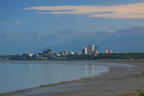
I wasn’t really sure what to expect when landing in Anchorage. I knew that the city was spread out and that the bus system was somewhat sparse. And while I didn’t get to spend much time downtown, I’ve come to the conclusion that Anchorage is not unlike any other small American city. It’s mostly strip malls and housing developments with mostly the same stores, restaurants, and architecture as you’d find back home, wherever home is. Of course there’s always some variation, but for the most part, Anchorage is a new city, developed in the last half century as a destination and port of entry for tourists. Thus if you’re looking for the “real Alasakan” experience, Anchorage is not going to be it. But for all of its generic features, it is still an interesting stop to visit. For one, the city sits at the foot of some rather tall mountains, which gives it a scenic and picturesque setting. And you don’t have to go very far to see wildlife. There are resident urban moose that inhabit all of the city green spaces, and there are a lot of green spaces to visit. The city is quite spread out and public transportation isn’t always the best option. Fortunately, there is an extensive system of bicycle paths that can get you almost anywhere you need to go. It’s one of the more bicycle-friendly places I’ve seen. You can even cycle all the way to Seward along the old Iditarod trail.

Unfortunately because of the conference, I was not able to really explore the city much. I spent my time out at the University of Alaska at Anchorage, which is on the outskirts of town. There are a few lakes and some trails near campus that I did get to explore. I came across 3 moose – a mom and two calves – just outside of the dorm I was staying in. Of course I saw them when I didn’t have my camera, and didn’t see another moose the rest of the trip. But I did get my moose sighting. After the Conference, I rented a car to drive down to Seward. On my way down, I did get to stop along the coastal trail where I snapped the photo above. All through the conference, we had great weather conditions. It was cool and cloudy the first couple days, and then the sun came out and it was warm. By Monday the 15th, it was almost unbearably warm and humid compared to Idaho. But the biggest disappointment was that I woke up to a very hazy view of the mountains. A large fire had broken out in Denali National Park and the smoke had made its way south to cover most of southeastern Alaska. So much for super clear days, but I made the best of it. It was still clear enough to make out the white peaks of Denali and the Alaska Range from the coastal trail.

Seward and the Kenai Peninsula: June 15-17

Cook Inlet

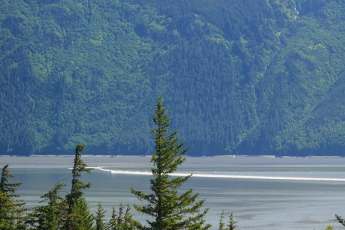
I left Anchorage and headed down for Seward. It’s only a 120 mile drive, but I left myself all day to stop and explore, and I still ran out of time. I thought I’d stop along the way and hike, but instead had too much fun at the many road-side stops along the Cook Inlet (pictured above). One of these stops was Bird Point, a popular place to watch the tidal bore come in. Cook Inlet is the only place to see a tidal bore in the United States and it produces some of the largest bores in the world with waves as high as six feet. The 15th was predicted to be a good day for bore viewing, and while I didn’t get a six-foot wave, it was still quite noticeable.

Tidal Bore at Bird Point

Tidal Bore at Bird Point

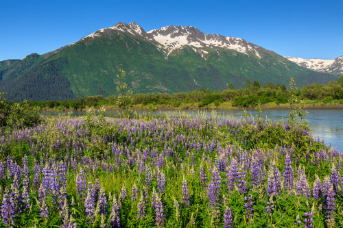
The Bore came in fairly late in the afternoon around 4:20pm. For Alaska, that doesn’t really matter. Sunset in Anchorage this time of year was 11:30, and the night never really gets dark enough to see the stars. As a result, it’s not hard to stay out late and forget to sleep. But the hostel I was staying in required I check in by 10:00 pm, and it was 7:00 by the time I reached Portage at the end of Turnagain Arm. With road construction, I was still about 2 hours away and needed to get into town with enough time to get some dinner. So I reluctantly continued the rest of the drive without any stops. Well, I made one stop. I found a patch of lupines next to one of the river outlets which was irresistible for a photograph.

Lupine and Mountains


On Tuesday, I met up with a friend I made at the conference who came down to Seward on the train. I had a car, so we decided to meet up and hike together. We went to the Alaska Sealife Center, a nice little aquarium that focuses on the aquatic life of Alaska. Unlike other large aquariums that showcase fish from across the globe, this one only features native sea life. It’s the only public aquarium in Alaska and the center also contains a research and rehabilitation facility. After touring the aquarium, we headed inland to hike to Crescent Lake. This 7 mile round-trip hike starts off steep, but reaches the valley floor at 1500 feet and levels off for the rest of the duration. Here we pass Carter Lake and view some spectacular scenery on the Kenai Peninsula.

The mosquitos were hellish on this hike. Until this point, I thought that either the mosquito problem was over-hyped, or that I had managed to miss the mosquito season. In fact, neither were true, I just managed to stay out of the mosquito infested areas. But here, in the wild lands, the mosquitoes were brutal. If we stopped for just a moment, they were all over us, and the DEET-free bug repellant just wasn’t cutting it. (Note: Heed advice and bring the strong stuff next time). There had been clouds overhead the whole time, but as we approached Carter Lake, I heard a deep rumble coming from over the mountain. “Is that thunder?” The weather forecast didn’t call for any kind of storms, but then, this is Alaska, and these are mountains, and in the mountains, anything can happen. The approaching storm did bring some refreshing winds that helped cool us off and give us reprieve from the mosquitos. I thought about turning back, but we had made it this far already, so why not go for the second lake. Besides a little hike in the rain isn’t that bad.

At Crescent Lake, we had enough time to stop and take a few photographs as the thunder drew closer and more frequent. Against better judgment, we stopped to find a geocache – you know, because we were there. Then we rushed back for the car. But when we hit Carter Lake again, the thunder suddenly and mysteriously stopped. I guess we dodged that bullet. Of course, the winds died down and the mosquitos came back out, so I’m not sure what was really worse.

On the trail to Crescent Lake Carter Lake Reflections Crescent Lake

[map style=”width: auto; height:400px; margin:20px 0px 20px 0px; border: 1px solid black;” gpx=”http://www.mineral2.com/wp-content/uploads/Crescent lake hike.GPX”]

Seward is mostly a tourist town. It’s the gateway to Kenai Fjords National Park where most people board day cruises to tour the bay, see glaciers, and spot wildlife including the many whales that frequent the inlets.  Seward is also a port of call for the cruise ships, so I imagine it can get busy on days when the ships are in. The typical tourist activities were out of my budget, so I stuck to the terrestrial activities. The whole expense of Alaska really limited my free time to only 3 days. Because the tourist season only lasts 3 months, the industry must take in its entire year’s operating costs and profits during this time. Thus hotels will run a minimum of $200 a night, renting a car can go for $100. I saved some money staying in a hostel, but I couldn’t do much in terms of transportation. If I had taken the bus or train to Seward, I’d be stuck paying a tour to get around. These are the trade-offs for visiting a land of intense and beautiful scenery. Maybe next time, I’ll drive up through Canada and camp. It might be more fun.

My flight back left Anchorage at 9:30pm on Wednesday the 17th. This gave me the day to drive back and explore more of the Seward Highway and the Kenai Peninsula. My first stop was Kenai Lake. This is one of the largest mountain lakes on the peninsula. It’s a mile wide and 22 miles long with steep mountains that line its shores. This might as well be an inland fjord. I had really only planned to stop at the road in to grab a geocache and move along. But I passed the cache and decided to follow the road to the campground just to see what it was like. When I got to the day use picnic area, I had to get out and see the lake. It was beautiful. The campground was beautiful. If I ever do get to return, this is a place I will spend a night. I was tempted to spend the whole day here, but alas, I had to move on.

Kenai Lake


The highway travels along several lakes outside of Seward. The next was Upper and Lower Trail Lakes. I enjoyed the view as I drove by, but made no plans to stop until I noticed the reflections in the water. I immediately turned around and pulled into a little picnic area along the shore of Upper Trail Lake. This is the only lake I came across with a glassy mirror surface. The reflections were perfect and the scene was iconic Alaska. I got my shots, grabbed a geocache that was hidden there, and moved along.

Upper Trail Lake

I intended to make one major stop at Portage Lake. This was my place to see a glacier up close – sort of. Portage Glacier still extends to the lake shore, and there were chunks of ice floating in the lake that had calved off of the glacier. But The glacier wasn’t visible from the visitors center and either required a short boat cruise or a hike from Whittier to the other end of the lake. I admit I was unprepared, and had I known the hiking options, I would have driven straight through the tunnel and hiked Portage Pass. Instead, I hiked the Byron Glacier Trail to view a smaller glacier that once would have helped create the lake.

Byron Glacier

The Byron Glacier trail is an easy .8 miles to the glacier viewing area, and then a more difficult climb over boulders to get to the glacier. I decided not to continue up to the ice and elected to explore some of the area near the lake. Despite not really hiking, I enjoyed my day. I did end up driving through the Whittier Tunnel only to discover that it’s a single lane tube shared with the railroad. Traffic is allowed through one direction at a time, and the direction switches every half-hour. I hadn’t really planned my time efficiently for once I got to Whittier, I almost immediately had to turn around and get in line for the drive back or I’d have to wait another hour and likely miss my flight. I didn’t make any major stops between Portage and Anchorage, since I had stopped along that route on the way down.

Conclusions

Alaska is very neat. It’s huge. There’s a lot to do, and if you only have a few days, it’s hard to decide what to do to maximize your time. It’s also very expensive during the summer, and that’s somewhat of a problem for someone living on a graduate student stipend. It’s also a place that would be a lot more fun to visit without a conference. For example, I would have brought my camping and backpacking gear along if I didn’t also need my computer and conference gear. That may have changed how I spent my time and my funds. I would certainly like to return, but maybe when I’m no longer a student.

Posted in Travel Stories | Leave a comment

East Moscow Mountain

[map style=”width: auto; height:400px; margin:20px 0px 20px 0px; border: 1px solid black;” gpx=”http://www.mineral2.com/wp-content/uploads/Moscow Mountain Hike.GPX”]

I had heard about the big trees on Moscow Mountain, but I had yet to experience them for myself. I first drove the road along the ridge back in 2010, the year I moved to Idaho. Back then, I passed some fairly large trees along the side of the road, and I assumed those were the trees everyone was talking about. But as I did some more research, I found that there really was a stand of old grown timber remaining on the north side of the mountain. The only problem is that it’s not well documented on the mountain itself. The trees are part of the old East Moscow Mountain park, which may or may not still be owned by the county. It’s clear that the picnic area near the Tamarack lookout is no longer maintained, but trails all along the mountain are maintained by the local mountain biking club. I suspect that they also maintain the picnic table at the cedar grove.

Big TreesWhen I first drove Moscow Mountain, I was able to drive all the way through, descending on Tamarack Road and riding all the way out to Troy. Last summer, the gate at the bottom of Tamarack Road remained closed through the season. So instead of parking on the ridge to walk to the lookout, people had to park at the bottom where the winter lot is generally plowed. That’s not really a big deal, it adds about a mile to the hike each way, and the ascending road is well shaded most of the way. But it does mean that a trip to the cedars and the lookout is going to require a good half-day’s commitment at least.

Both the lookout and the cedars are about 2 miles (give or take) from the lower parking area. When you hit the turn off to go to the lookout, instead continue straight on the road for another half mile until you reach what looks like a pull-off on your right. There you’ll see a trail enter the woods marked by two metal poles. Follow this trail about .2 miles into the heart of the old-growth cedars. There, you’ll find a picnic table surrounded by many impressively sized trees. You won’t find as many large trees as you would at Elk River or the Hobo Cedar Grove, but you’ll find some solitude and awe among some giants that rival the ones at the other groves.

If you combine this with the lookout, as I did on Sunday, the entire trip will reach about 5.6 miles. That’s not bad, considering you get to experience both old-growth forest and a stunning view of the Palouse, all within 15 miles of Moscow.

Big Trees on Moscow Mountain

Picnic Table


Sunday began sunny and hot. Temperatures had exceeded 80 degrees when I parked my car at the Tamarack trailhead. I huffed and puffed and sweated my way to the top where I noticed that the temperature and humidity hadn’t really gotten any better, but at least I was in the shade and on relatively flat ground. We’ve had an unusual weather year in north Idaho. It began with a less than stellar winter. That’s not to say it was a dry winter, but it was quite warm, so on the few occasions that we did get snow it melted away pretty quickly. For the most part, it rained in January and February, leaving the burnt of the snowpack to the high elevations. By late April and early May, temperatures had risen into the 80’s at times. This past week, it even got up to 90, which is average for the middle of summer, but not Spring. On top of that, we’ve been experiencing daily thunderstorms each evening for over a week. Spring rains aren’t uncommon here, but thunderstorms are. We get a few each summer, but that’s about it. This year, we’ve gotten more in one week than I remember in some years.

I chose Sunday for my hike because the weather forecast predicted a clear, rain-free day. But the storms were to resume by evening. I started my hike late in the afternoon and enjoyed my walk up to the cedars. There, I took a break and cooled off before setting out for the lookout. I knew my sunshine was limited when I noticed the soft cloudy light in the cedar grove. I didn’t mind, though. Those are the best conditions for photographing the forest. When I finally packed up and headed back, I noticed that the air was heavy. It was humid, like hiking in the east. Of course, the funny thing is that the humidity on a “humid” day is still less than a “dry” day in the southern Appalachians, but when most days are below 20%, a day above 30% feels balmy. As I reached the lookout, I saw storm clouds and rain across the Palouse heading my way. The rain looked to be over Lewiston and Clarkston, but it was moving slowly. I had enough time to enjoy a snack with my view before I raced back down to the car. I did manage to beat the storm, but I think it was also moving in a more easterly direction than north, so it may not have hit the mountain for quite some time.

A storm approaches Moscow Mountain from the southwest.

A storm approaches Moscow Mountain from the southwest.

Now that I know where the cedars are, and how far the hike is, I look forward to returning in the winter on snowshoes.

Posted in Hikes | Leave a comment

Small hikes near Moscow

The end of the semester is a busy time, and that often means foregoing larger adventures for some smaller ones closer to home. In the last week, I’ve been trying to keep active and take advantage of the local trails. One of these trails is the Headwaters trail on the western end of Moscow Mountain. In my five years here, I’ve never hiked this trail despite its close proximity and popularity among hikers, runners, and mountain bikers. Yet when all of my friends say they were on Moscow Mountain, they almost always mean the Headwaters trail.

Headwaters is a 5 mile lollipop loop around the drainage that creates the headwaters for Paradise Creek, Moscow’s main water feature. There are no major attractions along this trail such as stunning views for waterfalls, but it does offer a nice walk in the woods with some great opportunities for wildlife sightings and enjoying the spring wildflowers.  Since I hiked this after work on Friday with limited daylight, I did not bring my camera and thus have no photos to share.

[map style=”width: auto; height:500px; margin:20px 0px 20px 0px; border: 1px solid black;” gpx=”http://www.mineral2.com/wp-content/uploads/Headwaters loop.GPX”]


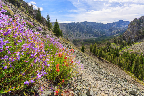
I’ve hiked Kamiak Butte many times. But each time, I’ve stuck to the main loop and ignored the relatively new primitive trail that takes you around the west end of the feature. Saturday, I did just that, hiking with a group of geocachers from Spokane and finding the last cache in the park. The primitive trail is a bit more difficult than the main trail. It’s narrower, rockier, and steeper, but it’s not by any means a strenuous hike. Instead, it takes you away from most of the crowds into some nice wooded terrain. During the descent, there is a spot that opens up with some spectacular views of the northwestern Palouse. The wildflowers this time of year are also pretty spectacular. Arrowleaf balsamroot are past their peak, but still dotting the hillside with splashes of yellow. Meanwhile, the larkspur and wild hyacinth have become abundant, and the phlox carpets the ground with little pink clusters. In the woods, the western meadowrue and fairy bells have begun blooming. Calypso orchids have been out for a few weeks, but are still going strong.

IMG_6328

IMG_6327

I have always liked Kamiak Butte, and with this extended loop, I like it even more. The full loop is about 4 miles long. Unfortunately, dogs are not permitted on the primitive trail, so plan on leaving your four-legged companions at home or just sticking to the main loop.

[map style=”width: auto; height:400px; margin:20px 0px 20px 0px; border: 1px solid black;” gpx=”http://www.mineral2.com/wp-content/uploads/Kamiak Butte with primitive trail.GPX”]


Posted in All Things Moscow, Hikes | 1 Comment

Blue Mountains: Panjab Loop

We open the 2015 hiking season with a fairly big hike in the Blue Mountains. The Panjab loop takes us up the Panjab Creek trail and back down via the Rattlesnake Trail in the Wenaha Tucannon Wilderness. This hike is full of wildflowers, wildlife, and canyon views. Continue reading

Posted in Hikes | Leave a comment

Yes, I’m still alive.

It’s been a long time since I’ve posted anything here. The purpose of this post is the reassure you that I’m still alive and kicking. There haven’t been many adventures and photo outings this winter for a number of reasons, the least of which is that it’s been a pretty lackluster winter in terms of snow fall. But I’ve also been busy with school and work and raising a child, and those add up. But as the snow melts and spring takes over the Palouse, I hope to get out more and stay active. So stand by and keep watching for updates to resume.

Posted in Personal Updates | Leave a comment

Annual Wallowas Weekend 2014

[map style=”width: auto; height:400px; margin:20px 0px 20px 0px; border: 1px solid black;” gpx=”http://www.mineral2.com/wp-content/uploads/Selected Data from wallowas 2014.GPX”]

The annual Wallowas Weekend tradition kinda took a hiatus for a couple of years. In 2012, Tyler had to pull out of the trip, and several other people followed. That left me with one other person who still wanted to hike, but also wanted to fish. So we turned it into a Seven Devils trip. Last year, I was still recovering from my ski accident and was in no shape to go backpacking. But this year, I was determined to get back in the game, and I didn’t disappoint. I chose a 24-mile loop to accomplish over three days. We’d climb a total of more than 6000 feet and finally summit the iconic Eagle Cap while exploring a total of four river valleys and a new lake. Tyler and I brought with us four newcomers to the Eagle Cap Wilderness, two of which were new to backpacking. It was a difficult trip, but we had a great time.

Day 0: Getting to Enterprise

The timing of this trip was planned around Tyler’s brother in law. Christian was visiting to drop off his car before heading to Germany for two years. He requested we take him backpacking in the mountains, and thus the annual Wallowas Weekend was reborn. We originally wanted to spend three nights in the backcountry, but none of our schedules meshed to allow that. So the best plan we could come up with would be to drive out there Thursday evening after work and car camp near the trailhead and then hike for three full days. There aren’t very many trail options to satisfy these demands. There are plenty of one-night hikes, and plenty of three-night hikes, but a two-night loop is in short supply, especially when we had to plan a true loop, unsure whether we’d have two cars to shuttle between trailheads. We did end up taking two cars for six people, but stuck to the loop motif anyway.

That’s because Tyler and I had a second mission. Every previous trip, we had stayed at Mirror Lake below the summit of Eagle Cap, and every year we look up at the summit and think that we’ll do it. This time, we wanted to make sure we made the 2000 foot climb. I figured we’d do the classic Mirror-Minam Lakes loop, but modify it to hike over Horton Pass rather than Carper Pass. This way, we’d hit the summit of Eagle Cap and get to experience some more scenery than if we had taken the shorter and more popular route.

And so came Thursday, September 11. We all left work a tad bit early to pack up the cars and get to Enterprise before dark. For convenience, we planned to eat dinner in town and ended up at the Terminal Gravity brewpub for a pre-hike beer and meal. But that meant we were setting up camp in the dark. We camped at a very nice campground about 1/4 mile before the Two Pan trailhead. The parking lot was pretty crowded, but the campground was relatively empty. We set up our tents, I set up my hammock, and we had a fairly cold night next to the river. At least nobody forgot his sleeping bag this trip, and we were able to pack up and get an “early” start on the trail.

Day 1: Lostine River to Mirror Lake (7.2 mi., approx. 2000 ft. up)
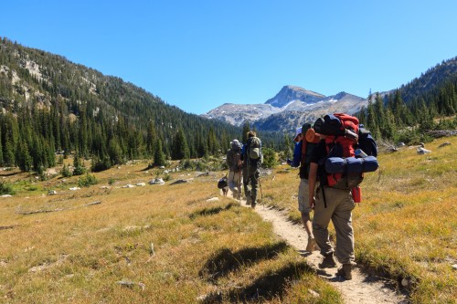
On our way to the lakes via the West Fork Lostine River trail.

On our way to the lakes via the West Fork Lostine River trail.

We left the trailhead promptly at 10:00 am. This was the same trail that Tyler, Matt Pennell, and I hiked on our first trip in 2010, so Tyler and I at least knew what to expect from this day. Despite not having hiked with a heavy pack in over a year, I handled the climb much better than I did the first time. We stopped for our first lunch break at the waterfall about 2.5 miles in. We had already climbed about 1300 feet at this point and were making great time. It wasn’t long before we hit the great meadow and the majestic view of Eagle Cap looming in the distance. Here, the trail mellows out, staying relatively flat for the next 3miles. Near the back of the valley, the trail crosses a bridge over the Lostine River. We planned to use this as a great rest stop and photo opportunity, but there had been a group of horse packers hanging out near the bridge, so we ended up stopping for an extended lunch break shortly up the trail.

The weather was perfect – blue skies and moderate temperatures that made a rest in the grass all the more pleasant. Since we were making great time, we could afford to rest in the valley and enjoy the tranquility of the landscape. Some day, we’ll plan a trip where we camp in that meadow. But for now, we had to show everyone the experience of a night at Mirror Lake.

We started moving again after we noticed several groups of hikers heading in our direction. Mirror Lake is typically the most crowded spot in the Eagle Cap Wilderness, and we wanted to be sure we found a good campsite before it was taken. We arrived at the lake at 4:00. Had we not stopped, it would have only taken us four hours. But the breaks were worth it and well earned. Surprisingly, we found a campsite overlooking the lake with no problems. In fact, the ranger came by and said she had only counted about 25 people staying that night. I suppose that’s the result of hiking on a weekday on a non-holiday weekend.
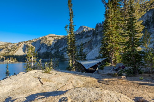
Camp at Mirror LakeWe set up camp and explored the lake a bit before making dinner. Urs made us some of his alpine pasta, a combination of noodles, potatoes, caramelized onions, and cheese. It hit the spot and warmed the belly as the temperatures dropped. That night was the warmest night that I slept. There’s something about the fall inversion that really brings that cold air down to the river valleys, but leaves the high lakes fairly warm. We finished the day by laying out and looking at the stars. For some, this was the darkest sky they had ever experienced. It really is a marvelous sight.

Day 2: Eagle Cap, Frazier Pass and Minam River (9 mi., 3000 ft. total climb)
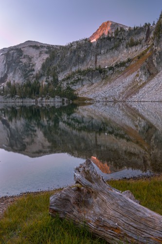
Sunrise on Eagle Cap

Sunrise on Eagle Cap

When I’m backpacking, somehow I manage to wake up just before the sun rises. That means I get to make images like the one to the right. It’s that very reason that I’m willing to load up my pack with extra weight and carry a tripod. That first light is the best time of day. It’s cold, but you know that very shortly, the light will bath the campsite and immediately start to warm everything up.

Our second day was to be our hardest and longest day of the trip. We originally planned to hike 11 miles and camp at Minam Lake after climbing to the summit of Eagle Cap. We didn’t quite make it that far, but it turned out to be a blessing that we didn’t.

We began our hike on the East Eagle Trail which climbs from the lakes basin up to Horton Pass. This was new terrain for all of us, and so it was quite exciting to photograph some new scenery. After passing Upper Lake, the trail quickly climbs up a series of switchbacks while opening up views of the Lostine River valley that we hiked up the previous day. Then the towering Matterhorn appears over the Hurricane Creek valley. At this point, the trees become dwarf and sparse. At Horton Pass, there are barely any trees at all. Ironically, the other side of the ridge is full of them. In fact, there’s even a sparse forest of dwarf trees at the summit which might provide enough wind shelter to set up a tent up there.

The trail to the summit leaves the East Eagle Trail before Horton Pass. It climbs up a series of switchbacks before reaching the ridge. At this point, we get our first glimpse of the southern half of the Wallowas. It’s quite a sight. It’s a steep drop straight down into the East Eagle River basin. One wrong move and you might slide all the way down to the bottom. But the trail is well maintained and well travelled, and since there are trees surrounding you, there’s no imminent risk.

From the meeting with the ridge, it’s a fairly steep 900 foot climb over the course of a mile. Most of us dropped our packs or the majority of the contents of our packs for the last part of the climb, which helped speed up the ascent. After all, at over 9000 feet, the air starts to get thin and any bit to reduce exertion will save us later on.

View of the lakes district from the summit of Eagle Cap. Mirror Lake is front and center.

View of the lakes district from the summit of Eagle Cap. Mirror Lake is front and center.

The summit of Eagle Cap is at 9573 feet above sea level, making it the 8th highest peak in the Wallowas. It sits right in the middle of the mountain formation, and as a result, stares at more glacial valleys than any other peak in the range. The views are some of the best around. We could see a fire burning in front of the Seven Devils. Hells Canyon is barely visible beyond the Wallowa River Valley. On a completely clear day, we were told that some of the high volcanoes from the Cascades are visible from the summit. It wasn’t the clearest of days, but it was clear enough to be impressive. It certainly could have been much worse, and after experiencing thick smoke haze in Moscow this week, I’m thankful for the conditions that we did have on the mountain.

We spent well over an hour on the summit eating lunch, enjoying the views, and resting in the high altitude. It was certainly the high point of our trip. But all good things must come to an end, and eventually we did pack up and head back down the mountain. After all, we had 8 more difficult miles planned and only the afternoon to complete them.

Everyone always dreads hiking uphill, but always underestimates the downhill. The uphill might be more energetically expensive, but downhill is more taxing on your body. Uphill, you’re pushing against gravity. Downhill, you’re fighting gravity for control. That fight wears on your knees and feet. Thus, going down can sometimes hurt more than going up.

We ascended 2000 feet from Mirror Lake to the summit of Eagle Cap. We descended 3000 feet from the summit to the intersection with the Frazier Pass trail. That initial descent from Horton Pass was steep and rocky. By the time we reached the Frazier Pass trail, we were already exhausted. The campsite by the river looked inviting. But we couldn’t stop there or we’d have a major 10-mile hike out the next day. So, over Frazier Pass it was.

Descending into the valleyBut before I get to Frazier Pass, let’s talk about the East Eagle River valley. In short: It’s beautiful. But it’s also very different from the Lostine River valley. As we descended Horton Pass, we could see a nice meadow down below. We would end up hiking through it before crossing the river and ascending up the other side of the valley, but the first thing I noticed was that the plant community was very different from the northern valleys. There seem to be fewer flat shelves with meandering streams and more of a deliberate slope to the whole valley floor. It’s not that it’s any better than the north. It’s just different. In fact, each valley seems to have its own unique character, distinct even from the next basin over. No two valleys are alike, which makes the prospect of returning to explore more of the area an enticing possibility.
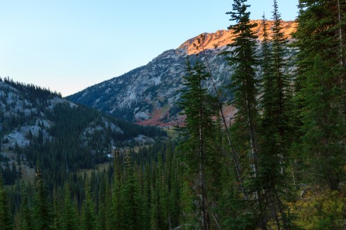
Last light as I descend into the Minam River Valley.

Last light as I descend into the Minam River Valley.

Frazier Pass is a difficult trail, especially after having hiked seven miles with a major elevation gain and loss. We had two more miles to hike before reaching the Minam River where we could have the option to cut the second day short and still have a manageable last day to hike out. This required a steep climb of 1000 feet in one mile, and then a descent of 800 feet for the second mile. My feet were done, so this last stretch was slow and excruciating for me. Yet I pressed on. I made it to the river as the light was fading. Everyone else had already arrived and had chosen a suitable campsite for the night.

The advantage of sleeping in the valley is that we could make a fire. And that’s one of the first things we did. We had a nice fire going to keep ourselves warm while we set up camp and got dinner going. I don’t think we were so grateful to have a fire to relax by than we were this night. It was a chilly night, but nothing we couldn’t deal with. It still wasn’t as cold as our first night car camping by the trailhead.

Day 3
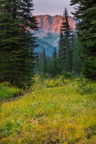
Sunrise from our Minam River campsite.

Sunrise from our Minam River campsite.

Again, the reason I bring my tripod is to get shots like this.

Throughout the night, I had been hearing the sounds of elk in the valley. So when I was awoken by elk bugles, I looked across the field from my hammock and thought I saw some grazing. That prompted me to preemptively wake everyone up for an elk sighting. I should have fished out my glasses first, because it turns out the dark blobs I thought were moving around were really just trees. Oops!
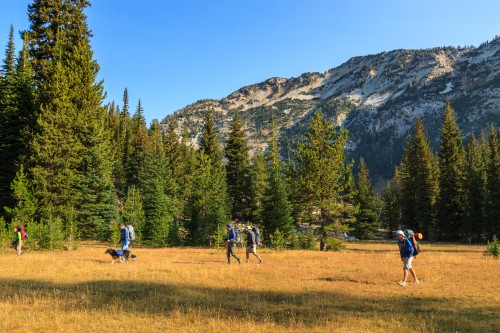
Leaving CampWell, it’s a good thing I woke everyone up or we would have slept in later than we wanted. We only had an 8-mile hike out to the car which, with short breaks, we estimated would take us 5 hours to complete. We left camp around 9:00 and headed up the trail toward Minam Lake. It was a gentle 700-foot climb over two miles through a combination of beautiful forests and open meadows. It was a much needed reprieve from the strenuous terrain of the day before. We reached the lake and stopped for a quick view, but decided not to take an extended break. We stopped once more near the northern end of the lake for a second view and then headed down into the valley.

The West Lostine Valley is similar to the East Lostine valley on the other side of the ridge where we hiked in, yet it’s quite different. The grasses are short and the meadows are fla just as its eastern sister. But this fork has more water in it. The meadow isn’t nearly as long, so there’s more time spent in the forest, especially after descending and meeting up with the Copper Creek trail.

Despite the more constant descent on the trail’s elevation profile, there were some steep sections along the trail which made me glad we didn’t go up this one. But overall, it was an easy and scenic 8 miles. As we descended the last switchbacks near the confluence of the east and west forks, we celebrated the end of our hike. As predicted, it took us five hours to reach the trailhead, just in time to pack up and head back to Enterprise for a post-hike beer and burger at Terminal Gravity.

This was my first backpacking trip since injuring my leg skiing last year. Even with an overweight pack and some strenuous terrain, my hip and knee performed like a champ. Yes, I came out sore, but not from my injuries. The worst part was getting out of the car in Enterprise after sitting for an hour. At that point, my calves did not want to support me. I was still hurting a bit Monday morning, but by the end of the day, I was feeling back to normal. It helps to be walking around.

This year’s Wallowa Weekend was a success. I’m already excited to plan next year’s adventure. I’m determined to keep the tradition alive until I leave the area.

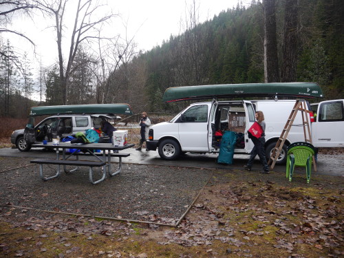
Posted in Hikes | Leave a comment

Oregon Butte

In a world where there are so many playgrounds at arm’s reach, the Blue Mountains of southeastern Washington are so often overlooked. They’re not as tall as the surrounding mountain ranges – the highest point is just shy of 6400 feet. There are no natural lakes, and the valleys are actually canyons carved into an uplifted basalt lava flow. But while they may not have the grandeur of the nearby glaciated Wallowas, the Blue Mountains are quite beautiful and offer some great hiking experiences. A large portion of the Blue Mountains is protected under the Wenaha-Tucannon Wilderness Area, and a network of trails takes hikers from the scenic ridge tops to the raging rivers for a plethora of panoramic viewpoints and wildlife viewing opportunities.
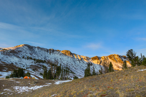
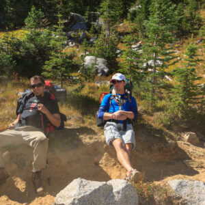
At 6387 feet, Oregon Butte is the highest point in Washington’s Blue Mountains. That puts it on par with other local peaks such as Grandmother Mountain. Temperatures are often 20-30 degrees cooler than the surrounding cities which makes this hike a great place to escape the summer heat. The Blue Mountains are drier than some of the other mountains of comparable height, and that can be reflected in the vegetation. However, there are plenty of reliable springs with great tasting water. While the official government warning states to treat all water in the backcountry, these springs feature pipes coming directly out of the ground and are generally safe for direct consumption.

The summit of Oregon Butte with the fire lookout.

The summit of Oregon Butte with the fire lookout.

The hike to Oregon Butte is an easy 3-miles from the Teepee trailhead (see map below). You’ll gain about 900 feet in elevation while walking through lush ridge-top forests and mountain meadows. In late spring-early summer, this area is carpeted in wildflowers. In late summer, it’s nice to see that there is still green left on the hills when everything else has turned brown. There are still wildflowers blooming. The fields contain an abundance of western aster, paintbrush, goldenrods, and other late-summer flowers. The huckleberries are also ripe, though not nearly as abundant as they are at Freezeout.

The view on Oregon Butte is nothing short of amazing. On Saturday, I could see 90 miles to the Seven devils. The Wallowas were quite visible as were the Elkhorn Mountains and Moscow Mountain. According to some, that constitutes a clear day. However on a really good day, the view extends to over 200 miles. Spokane Mountain becomes visible to the north, and during the twilight hours, the shadows of Mt. Rainier, Mt. Adams, and Mt. Hood are all visible to the west. That’s not bad for a small mountain range. Of course, in the middle of the summer fire season, visibility might also be limited to just a few miles, so plan your trip accordingly.

View from the lookout on Oregon Butte.

View from the lookout on Oregon Butte.

[map style=”width: auto; height:400px; margin:20px 0px 20px 0px; border: 1px solid black;” maptype=”TERRAIN” gpx=”http://www.mineral2.com/wp-content/uploads/Oregon Butte Hike.GPX”]

Posted in Hikes | Leave a comment

August Update

I just realized that August has come and gone and I have yet to write about anything that happened during this month. It’s not as though I haven’t done anything. In fact, I was quite busy every weekend. So, let’s see, what happened in August?

It got really hot. In fact, it got so hot, that doing things became unpleasant. Nevertheless, we took Clara out to Elk River to beat the heat. At first, she didn’t like sitting in the cool water, but by the end, I got her to tolerate it.

Moscow Mountain from Kamiak Butte

Moscow Mountain from Kamiak Butte.

We also took Clara up to Kamiak Butte. I’ve always been up on Kamiak Butte in the spring when the Palouse is still green and the wildflowers are at their best. It’s quite different to see the land in late summer. This was also Erin’s first time on Kamiak Butte as well.

I finally brought some graduate students up to Grandmother Mountain. It rained on us a little bit, but not as much as when I was up in July with my mother. Rain at Freezeout seems to be a theme this year. We had a great hike and everyone was amazed at the views up there. That’s also when I discovered that the huckleberries were ripe and it was a good year for the berries.

So the next week, this past weekend, Erin and I brought some friends up to Freezeout to collect huckleberries. On Saturday, we brought home 1 liter of berries between the two of us. Again, we ran into a bit of rain. We had such a great time that we actually went back up again on Monday with some more friends and brought back two more liters. Since we still have berries left from last year’s harvest, we’re pretty well stocked for a while. But don’t worry, we’ll get more next year.

The view from the summit of Grandmother Mountain.

The view from the summit of Grandmother Mountain.

While we’ve been pretty busy, I haven’t given the camera much action. But that should change. I’ve got some exciting trips lined up for September, starting with a hike to Oregon Butte in Washington’s Blue Mountains coming up this weekend, and the return of the annual Wallowas Weekend backpacking trip next weekend. I’ve got to get my hiking in. It’s been a pretty inactive summer, and the season soon coming to a close. I am looking forward to snowshoeing this winter.

Posted in Hikes, Personal Updates | Leave a comment

Roman Nose Lakes

Upper Roman Nose Lake with Roman Nose peak rising behind it.

Upper Roman Nose Lake with Roman Nose peak rising behind it.

Last year, I tried to take my family up to Harrison Lake to enjoy a true alpine zone. When we got close, we saw that the lake had been closed due to problematic bear activity. I would have still been ok hiking up there, but my parents were wary, so we came up with an alternative: Roman Nose. There used to be a road connecting the Pack River to Roman Nose lakes on the other side of the ridge. That road is no longer passable except by ATV or mountain bike. We found that out the hard way. On the bright side, we ended up discovering a great patch of huckleberries and came home with almost a full gallon of them.

This year, I wanted to make up for last year’s shortcomings and head straight for the Roman Nose Lakes. Besides, Erin is not yet ready for the level of difficulty of the Harrison Lake hike. But Roman Nose is an easy hike at just under 3-miles round trip to one lake and not much elevation gain. The plan was to leave early and get to the trailhead before noon. We’d hike out to the upper lake where Erin and Clara and my parents would hang out for a while, and I would continue up to the summit of Roman Nose for some sweet panoramic vistas. Then we’d stop and pick more huckleberries on the way down and end the day with a nice dinner in Sandpoint.

Of course, nothing ever goes according to plan. Here’s what really happened. We left the house after 9:00, which would have put us at the lakes around noon. But along the way, Clara needed to be fed. Actually, Clara was sleeping just fine in her carseat, but Erin needed to feed her to feel comfortable. So we stopped at the Coeur d’Alene Casino for about an hour while she nursed. We got back on the road and made it smoothly into Sandpoint and continued north to the road accessing the lakes.

Now, if you look at Google Maps as well as the maps on a Garmin GPS, there appears to be three roads that lead up to the lakes. One of these is the correct route. My GPS chose one of the alternates, which if maintained would be the shortest and fastest choice. However, about 3 miles before the routes converged near the destination, that road becomes washed out to the point where I’d be wary of even bringing a heavy duty SUV. So, we got close, but had to turn around and backtrack, during which we had to stop again to nurse and change a diaper. Luckily there was a geocache hidden by a stream crossing, so we stopped there for a while. I pulled out the hiking guide book and sought out the recommended directions up to the lake. Of course, I didn’t quite read them correctly and thought that the road we wanted was just at the base of the road we were currently on. As we started up that road, I found the correct road on the GPS, so we turned around again and headed for the right road.

Of the three routes up the mountain, the correct one is the longest and furthest away. But otherwise, it’s a well-maintained and relatively smooth road, at least compared to the unmaintained roads. But then, Roman Nose Lakes is a highly used area, so I was expecting the access to be easy. We finally made it up to the parking area by 4:00 pm. At this point in the day, I wasn’t going to be making any runs for the summit, and I had to make a convincing point to even hike out to the upper lake. But we did, and it was awesome. Erin made it with no problems and Clara enjoyed her first hike. With all of the stops for feedings and diaper changes, we made it back to the car by 7:30 and made it back into Sandpoint too late to dine at our preferred restaurant. And, we didn’t get to collect any huckleberries.

Despite our misadventures, the Idaho Selkirks are awesome mountains, and I do regret not having spent more time up there in the past four years. I look at these last two trips as learning experiences. I now know how to get to my destinations, and traveling that long of a distance with an infant will require an overnight stay if we are to get anything accomplished. In the mean time, I really want to go back and stand on top of Roman Nose and hike to Harrison Lake and perhaps also stand atop Harrison Peak. I want to backpack in to some of the other lakes where the hikes are too long for just a day. And perhaps maybe I can get back up there without Erin and the baby and accomplish one of those goals before winter hits this year.

FYI: The correct direction to Roman Nose Lakes is to take Snow Creek Road. Even Google Maps wants to route up Ruby Creek Road, but this is impassible without an ATV.

[map style=”width: auto; height:400px; margin:20px 0px 20px 0px; border: 1px solid black;” gpx=”http://www.mineral2.com/wp-content/uploads/Roman Nose Lakes Hike.GPX”]

Posted in Hikes, Travel Stories | Leave a comment