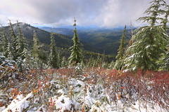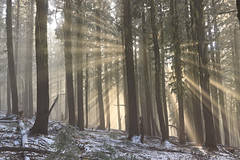
Interestingness

Since I started using Flickr to show of my photography to the world, I’ve neglected my own self-hosted galleries here at Mineral2.com. I’m considering doing away with the Gallery software altogether and maybe swapping it out for a simpler interface for displaying a portfolio.

At any rate, Flickr has been a much better interface for me because in addition to being a photo hosting site, it’s also a social network and that allows me to get greater exposure into the world. One of the things Flickr does is rate your photos according to “interestingness.” I’m not exactly sure what that entails, but its some magic formula combining the number of views, comments, and favorites an image receives, and I’m sure the rate at which these are received is taken into account. Every day, Flickr takes the top 500 uploads and displays them in a section they call Explore. Given that there are millions of photos uploaded each day, making it into Explore is quite challenging, but also quite an honor. Or maybe it doesn’t really mean anything at all. What confuses me is that most of the images that make Explore probably don’t deserve to be there. After all, the algorithms used to generate the interestingness score are more so a reflection of popularity than the technical quality of a photograph. In addition, a photo with fewer views, comments, and favorites can be ranked higher than one that exceeds it in all three categories. So while it’s fun to get a photo into Explore, it’s not necessarily a reflection of your ability.

Flickr also uses this algorithm to return back to you your top 200 interesting photos from your photo stream. I mostly keep track of the top 20 from time to time to see if the list matches my top picks. For the past few years, my top three images have been some old favorites: the waterfall at Heatherbrook, Mount Washington from Mount Chocorua, and Blue Mine (Wyanokie) Falls.
The Waterfall at Heatherbrook Mt. Washington from Mt. Chocorua Blue Mine Falls

In fact, it seemed that a good handful of the top 20 were waterfall shots. Most of the top 20 dated back to my film days, and only one made the list from my first year in Idaho. In short, the top 20 seemed pretty robust. But recently there was an upset that changed my top 20. Two images from the past week jumped right up into the list, one of which landed in the number 3 seat. Both of these images coincidentally also made it to Explore for their respective upload dates.
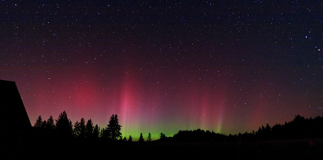
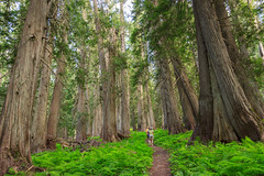
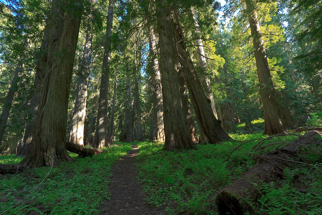
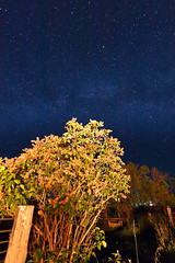
Aurora The Enchanted Forest

It’s kind of neat to see that this list really isn’t as robust as I thought it was, that an image had to stand the test of time and gradually rise to the top. I’ll never understand just how Flickr’s algorithm chooses the best images, but I’ll be keeping an eye on the interestingness to see how it changes.

The full list can be seen at http://www.flickr.com/photos/mineral2/popular-interesting/.

Posted in Photo Blog | Leave a comment

Grandfather Mountain: A pre-winter hike

On Grandfather Mountain

Looking back (south) on Grandfather Mountain


I’ve been very busy with graduate school, and that has put hiking and exploring on hold, but that also has me itching to get out, especially as my days of decent hiking weather grow shorter and shorter. I’ve been trying to get up to Sandpoint to get in one last snow-free summit for the season, but time just hasn’t been on my side. So this weekend, I headed up to Grandfather Mountain with Erin for what might be our last chance to get up there this year.

I’ve been to Grandmother Mountain many times since moving out here, but each time, we get started late or take too much time exploring the trail to make it all the way to Grandfather. This time, we skipped Grandmother altogether and set Grandfather Mountain as our goal. Grandfather is exactly 4 miles from the trailhead (according to the GPS), and the first half of the hike covers the same familiar ground that we’ve hiked time after time. Regardless, I never tire of the scenery along the trail. At 6000 feet, the views are incredible, and even though the mountains aren’t that big for this area, they’re still impressive. And then there’s the thrill of seeing it differently every time. For example, when we first discovered this trail last September, summer was ending and fall was just staring so we had a hike full of late-summer flowers and huckleberry bushes turning red. In July, Spring was kicking off with a magnificent show of color and wildflowers. On this hike, a fresh two-inches of snow had fallen the night before and we laid witness to the mountain’s transition from fall to winter. Luckily, we were still able to get to the trailhead.

So we made it through the first half of the hike as usual, but stopping less often. But at the spur to Grandmother Mountain, we turned left and continued along the ridge. Not long after, we came across a perfect campsite next to a spring under the canopy of the old-growth forest. Then the forest became a bit younger and denser, but nevertheless, it was great to walk through a forest instead of through open fields and patches of trees. Although it had snowed the night before, when the sun came out, the air felt pretty warm and we could feel the snow melting around us. Steam rose up from the ground encasing the ridge top in a thin cloud. When the sun would shine through, we would catch the rays bouncing off the mist.

Eventually, we ascended out of the forest and into a clearing at the summit of Grandfather Mountain. The views are pretty, but not quite as open as they are on Grandmother Mountain. Still, there’s fewer ridges to block the valley to the north and there’s a different perspective looking back where we came from to the south. So while Grandmother Mountain may be taller and have the better views, it’s still worth making the extra 3-mile (round trip) trek to Grandfather Mountain, if anything for a nice walk through the ridge-top forest.

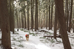
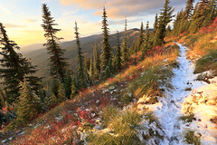
View from the Grandfather Mountain trail. The Enchanted Forest

Romp in the Snow Grandfather Mountain Trail

See more photos from this hike on Flickr.

Posted in Hikes | Leave a comment

Aurora

Aurora

Tonight I had a great surprise and learned a valuable lesson as to why it’s somtimes good to stay up late, even on a school night.

I got the word of an aurora event tonight around 11:30 local time, and this was from people on the east coast. So I thought to myself: I wonder if I can see it here. I went outside and didn’t see any dazzling lights dancing in the sky, so I came back in thinking that either I missed it or I was just in the wrong place to see it.

But then I started thinking: what if the aurora is just too dim for the naked eye to see, but bright enoug for the camera to pick up? I asked my wife how bright the aurora usually is and she said it depended on the circumstances. Some are bright and some are dim.

I went back outside and looked to the north and saw that the sky was somewhat bright… like light pollution. But in that direction, there are no towns to produce light pollution. I got the camera out of the car and set it up on the tripod and snapped a shot. Sure enough, my suspicions were confirmed when the hazy glow turned out to be green and pink. My other suspicion came from a ray of light shining up from behind the trees, almost as if someone had a spotlight. Then the beam disappeared. It would reappear in different places throughout the night and the sky would vary its intensity.

I saw a freaking Aurora.

Posted in Photo Blog | Leave a comment

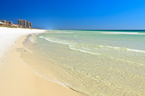
I went to Florida


I went to Florida, originally uploaded by Matthew Singer.

Taking a break from the usual trips into the mountains, I went to Florida last weekend to celebrate the marriage of one of my good buddies. The wedding was in Pensacola Beach, with the actual ceremony on the beach outside of town.

I’ve been to Florida before, but not the Gulf coast, and especially not the panhandle, and so when I got there, I was quite surprised at just how built up it was. When I think of Florida, it’s usually the Tampa/Orlando area, which I try to avoid, or the south-Florida beaches, keys, and the Everglades. To me, the panhandle was just an extension of Alabama and Georgia.

Pensacola Beach is quite nice. It’s a barrier island made up of nearly pure quartz sand which is why the beaches are so white. The Gulf waters have a clear turquoise hue that becomes brilliant blue as the water gets deeper. Despite being so far north and so late in the season, there was still good beach weather, helped by the nice warm water. Daytime highs were anywhere from the mid-70’s to low 80’s with cool breezes and, surprisingly, low humidity. You could not ask for anything more perfect. Nights and mornings were chilly, but bearable.

As I mentioned before, we were down for a wedding, and were staying with a few other folks from the U of I. We all split the cost of a rental which meant we all had to travel together, so there wasn’t much sight seeing. There really isn’t a whole lot to see beyond the beach anyway. Pensacola is a Navy and Air Force town, next to one of the largest bases I’ve seen. The barrier island is also home to the Gulf Islands National Seashore, offering miles of undeveloped beach and island habitat that would have been fun to explore.

Luckily, due to to a scheduling error (I thought I had booked my flights home for Sunday), we had an extra day in Pensacola, and after dropping people off at the airport in the morning, we headed back to the island to check out Fort Pickens, a civil war era fort at the end of the island. With some more free time, this area seems like a great place to watch for birds and other wildlife. I’m thinking that if a similar situation arises again, Erin and I will arrange to have our own transportation so that we can go out on our own.

So, there you have it. I have now been to Pensacola, the Florida panhandle, and the gulf coast.

Posted in Personal Updates | Leave a comment

Eagle Cap Wilderness, Labor Day Weekend

West Fork Wallowa River Valley

The West Fork Wallowa River Valley from the Lakes Basin Trail

A year ago this weekend, I set foot in Oregon for the first time and explored one of its most beautiful and least advertised mountain ranges. Last year, we only got a preview of the Eagle Cap Wilderness in the Wallowa Mountains, only able to stay one night. So this year, I arranged the backpacking trip for Labor Day Weekend, which let us spend 3 nights in the wild and explore more of the area. I rarely return to the same place for a second trip as there is so much around to explore, but then, there is the trade-off. Is it better to see a little bit of everything, or thoroughly explore one place?

And so it was, I returned to the Eagle Cap Wilderness with Tyler and we brought Tyler’s fiancee, Genevive, and Tom Poorten, two newcomers to this wilderness. Of course, Rusty and Shadow came as well. Since we couldn’t all fit comfortably into one car, we took two and hiked a shuttled one-way route, hiking up Hurricane Creek to Mirror Lake and heading out down the West Fork of the Wallowa River. This route is a much longer way into the lakes basin than last year’s Lostine River trail, but it’s also the easiest way in, especially when the 12 miles to Mirror Lake are broken up into two days. And that’s just what we did.

Originally, we were to start hiking around 6 or so and hike for about four miles and find camp. But as usual, we were late leaving Moscow and we got into Enterprise at 7. After parking a car at the Wallowa Lake trailhead in Joseph and shuttling over to Hurricane Creek, we got our start on the trail well after dark had fallen. We hiked for an hour, just shy of two miles, before finding a spot in the meadow to make our first camp. Friday night was cold, so cold in fact that we not only had a frost, but I woke up with ice in my water bottle. Temperatures remained near freezing through the morning until the sun had risen high enough to hit the valley floor. We ended up waiting long enough to let the sun warm us up and dry the tents before heading up the valley.

The Hurricane Creek valley is magnificent. The entire trip is a gentle upward slope, rising about 2000 feet over 10 miles while surrounded by giant peaks rising upwards of 4000 feet into the sky. We woke up with a grand view of Sacajawea, the highest peak in the range. I must say it looks quite different without snow covering its rocky summit. After passing the giant mountain, we’re introduced to the white cliffs of Matterhorn, which due to its more vertical nature, looks even more impressive. The terrain is a mix of open meadow and forest, but nothing nearly as wide open as the upper Lostine River valley. Still, the diversity of terrain and scenery makes this trail almost more scenic than any of the other approaches. After hiking 10 miles in the valley, the trail climbs up one of the back walls via a series of gentle switchbacks and descends into the Lakes Basin area. The summit of Eagle Cap becomes visible and excitement washes over with the prospects of finally getting to the lake. Though the trail was relatively easy, we were quite bushed from hiking 10 miles uphill and quite glad to set up camp on the rocks with a great view of Eagle Cap and Mirror Lake.

Saturday night was much warmer, as expected. In the fall, mountains experience a temperature inversion from day to night where the cool temperatures fall into the deep vallies and the warm temperatures rise to the high elevations. As a result, we had a very pleasant night by Mirror Lake. In fact, after eating dinner and packing away the food, we sat out on the rocks looking at the stars.

We spent a relaxed Sunday morning enjoying the area around Mirror Lake. Originally, we had tenative plans to hike up to the summit of Eagle Cap, return and pack up camp and move about 3-4 miles down to Horseshoe Lake and hike out the last 9 miles on Monday. However, we were still tired from our 10 miles of hiking on Saturday, so we decided that a summit of Eagle Cap would have to happen on another trip. Then, pressed with the option of camping at Horseshoe Lake or continuing on into the Valley for a shorter hike out on Monday, we decided it would make more sense for the latter option so that we weren’t getting home super late. Regardless, we left our camp at Mirror Lake around noon and headed down along the lakes, taking short breaks at Moccasin, Douglas, Lee Lakes. We stopped for a long lunch at Horseshoe Lake and found a great jumping rock to plunge into the cold water. Surprisingly, Horseshoe Lake wasn’t too cold and the swim was quite refreshing for a hot day.

Mirror Lake is definitely the desired destination in the Eagle Cap Wilderness. It’s one of the higher lakes, is centrally located, and sets you up for a nice summit trip to Eagle Cap. But Mirror Lake is also quite popular, and the prime campsites near the water are almost always taken quite early. Despite the popularity, it is easy to find a place that is somewhat secluded and gives the impression that you’re not camping among a crowd. But the other lakes have their advantages too. They are quieter, they have more trees around them, they’re better for fishing, and they have some really awesome campsites. You can be certain to have privacy at these lakes, and still have world class views of the high peaks. The peninsula on Horseshoe Lake offers spectacular views of Pete’s Point and Sentinel Mountain, and from certain angles, you can also glimpse Eagle Cap. Horseshoe is still at 7000 feet, but as the last lake in the chain, it is warmer and more eutrified than the lakes uphill from it. In fact, there are a few nice marshy areas along the trail that look like great amphibian habitat. The water is still clear, and the lake is still deep. But there are likely to be more fish in there than at Mirror Lake.

After Horseshoe Lake, the trail drops into the valley of the West Fork Wallowa River. This descent, while not strenuous, is about 3 miles that would be a steeper incline in the other direction than any incline on the Hurricane Creek Trail. I’m certainly glad we chose the direction that we did. Shortly after the descent began, we came upon a rocky shelf looking over the valley. Convinced there was a view to be had, I dropped my pack and ran out to the rocks. Sure enough, there was a magnificent view of the back valley. The Wallowa River valley is a classic glacially-carved U-shaped valley about 3000 feet deep and maybe a mile wide at the base. The views we got from this rock were like those you’d get at a national park. It was glorious. The trail opens up again a few more times on the way down before reaching the valley floor at Six Mile Meadow. There is good camping at the meadow, six miles from the trailhead, but it proved to be a popular site, so we pressed on to see if we could find anything else nearby. Turns out, much of the Wallowa River valley is forested, unlike Hurricane Creek, and camp sites are few and far between. We ended up camping three miles farther at the intersection with the Ice Lake trail. This put us at a second 10-mile day, but would afford us the luxury of sleeping in a bit and only hiking out about 3 miles on Monday.

Sunday night was colder than Saturday night at the lake, but not as cold as Friday with the frost. We built a fire in the fire pit and sat around to keep warm during dinner. The morning was also cold, but not nearly as bitter as our first morning, so we were able to get moving fairly early. We ended up leaving camp around 9 and getting to the car well before noon. We celebrated with a post-hike beer and lunch at the Terminal Gravity Brew Pub in Enterprise, a well deserved treat after two back-to-back 10-mile days of hiking and three nights in the wilderness. Although I was sad to leave such a beautiful landscape, I was glad to be back in the comfort of my bed, take a break from hiking, and have a hot shower.

The Eagle Cap Wilderness is one of the most beautiful and special places I have been to, and that’s one of the reasons I keep returning. This will certainly not be my last visit or backpacking trip in the Wallowas as there are so many more places within these mountains to see and explore. I hope we can keep up this tradition and next year, I’ll get to report on the third annual Eagle Cap Wilderness backpacking adventure.

Posted in Hikes | Leave a comment

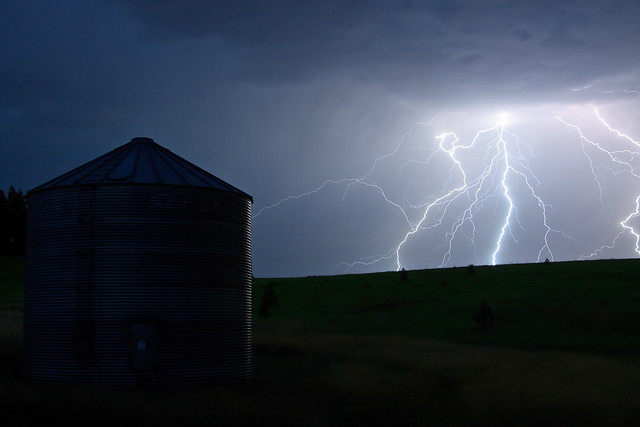
Storms

Approaching Storm, alternate take

Last night, we had the storm of storms come across the Palouse. It was a quick, but powerful cell the big lightning strikes every few seconds that produced enough power to disrupt phone service (land line) each time a bolt struck the ground. Luckily, we had no major power surges and all of the electronics in the house work just fine. But the ligntning and thunder show was both awesome and a bit frightening. I stood outside with the camera as the storm approached, but quickly retreated into the house as the storm came atop of me. Winds picked up and the temperature dropped twenty degrees. Unfortunately, as with all scattered storms, the effects were short-lived. As the storm passed and the winds died down, the heat came back, but at least it wasn’t nearly as hot as it was during the day.

I tried to get some shots of the storm leaving the area, but I had waited too long to get any good lighning shots with the barn in the foreground. This represents my first successful lightning photography. The last try failed to capture the bolts, but did capture that amazing red sunset.

Posted in Personal Updates, Photo Blog | Leave a comment

Escaping the Heat

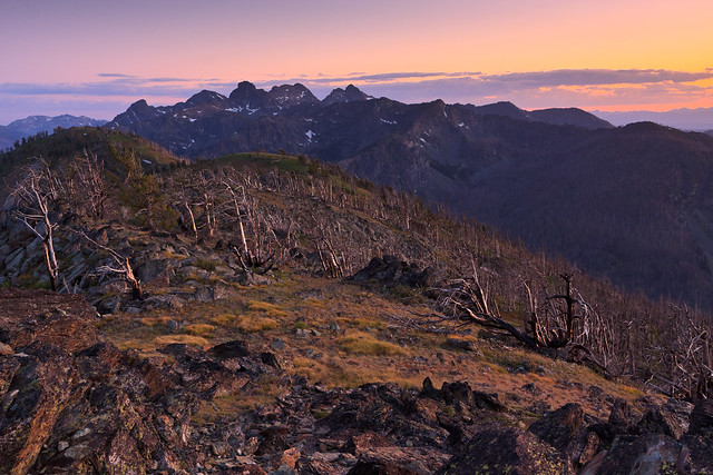
View from Crater peak

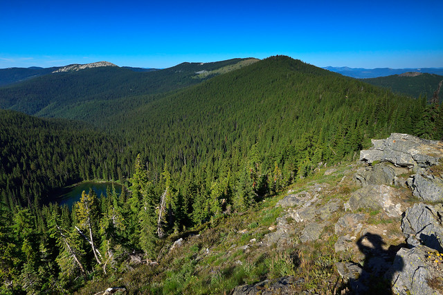
Escaping the Heat at over 6000 feet. This view is from Crater Peak. Below is Crater Lake and Lookout Mountain is the rocky peak in the distance.

While the east coast has contended with an earthquake and a hurricane, we have been enduring our summer heat wave, temperatures in excess of 90 degrees. It rarely gets to 95 out here, but when it does, it’s brutal. Of course, when it’s in the mid-90’s up on the Palouse, it’s over 100 down in Lewiston. Currently, our weather station reads 98 outside and 92 inside.

We don’t have air conditioning. There’s really no need for it. While it’s in the 90’s now, at night, it will cool off below 70, sometimes getting downright chilly. We wake up in the morning and the house is quite comfortable. It’s also only this unbearably hot for maybe 2 weeks out of the year. But this brings up some the question: how do we beat the heat? During the week, the answer is simple. I work in the lab. But I go home as the temperature has crested and the temperatures are still fairly brutal. The house, made of cinder block, holds that heat for a good time into the night, so as the sun sets, it can still be uncomfortable inside while very nice out. It does help keep the  house from getting too cold in the middle of the night. So how do I beat the heat? Here are a few ways:

1. Seek Shade.

I know what you’re thinking… What? 98 is 98, and 98 is hot in the shade or not. But here in Idaho, we don’t have the humidity levels seen by much of the eastern half of the country, and while 98 is brutal in the beating sunshine regardless of humidity, it does make all the difference in the shade. It is also the reason why the night cools down so much. Water is very good at holding its temperature, and it takes quite a bit of energy to change it. In Virginia, where the 95 degree day would be accompanied by a balmy 70-90% humidity, the sun heats up that moisture in the air, and that moisture retains the heat well into the night. Because the air is saturated, liquid, such as sweat, doesn’t evaporate as readily and you feel miserable. In contrast, the humidity reading out here is 18%, and with less water in the air to hold that heat, temperatures plummet as the sun goes down. But this also works in the shade too. So, 98 in the shade outside, especially with a nice breeze, is a much different place than 98 in the direct sun.

But 98 is still 98, and dammit, I need to cool off.

2. Cool off in Water

Yesterday, we had our annual Bio Department float trip on the Snake River. I was a bit worried that the 100+ degree temperatures were going to pose health risks being out in the sun all day with no shade. But it turned out to be quite a pleasant ride down the river. I have no idea what the actual water temperature was in the river, but I was so hot in the sun that the initial dip was chilling. But almost immediately, I acclimated and  the water felt good – not too hot, and not too cold. I also wore a shirt the whole time, which I kept damp and that helped keep me cool out of the water.

It was good to be on the water again. I haven’t done any river activities since leaving camp last summer, and I miss it, especially since the rivers here have enough flow in late summer to run and still have fun. And the scenery is different. It’s new. The canyon walls are so fun to look at. I think I’ve run the same section of the Shenandoah so many times that I’ve gotten bored with it.

I have no desire to submerge myself in the Snake River again. While it felt good, the water is pretty dirty and gross. After all, it has been flowing from the Tetons, past the cities, farms and cattle feed lots of southern Idaho. I can only imagine how dirty the water gets downstream of Lewiston where we add shipping traffic to the mix. The nearest water sources to home are the Potlatch River at Little Boulder Creek or Elk River. The Potlatch River would be a good place take the dogs to wade in the water. It’s not really deep enough to swim. Elk River has a little swimming hole below the upper falls and might be good to check out, though the water originates high up in the mountains and I hear it’s quite cold.

In Virginia, we would hit up one of the swimming holes on the creeks coming down the Blue Ridge in Shenandoah National Park. While these creeks weren’t fed by snow melt, they did take on ground water throughout their journey to the Shenandoah River, and so the temperature of the streams was probably 50-60 degrees, or quite fidgid. But on a 90+ degree humid day, a dip in the cold water felt refreshing.

3. Head up in elevation.

When summer camp came around, I generally had a 2-week session (7-8th grade, or 9-12th grade) during the hottest weeks. We couldn’t really change our trips around the weather, so we had to make due and work with what we had. Backpacking in the heat is no fun, and backpacking with a bunch of students who don’t usually do this for fun in the heat is no fun. Our philosophy was to teach the kids leadership and responsibility and let them choose and plan their own trip. But I was able to slyly craft my suggestions into their plans. I’d often convince them that a hike in the central district of Shenandoah National Park was the way to go: best views, most attractions, and, most of all, highest elevations. Nearly all of the AT in the central district is above 3500 feet, with high spots reaching 4000 feet. That’s almost 3000 feet higher than camp, and more importantly, at least 10 degrees cooler than camp. So if it was supposed to be 90 in Luray, it would be around 80 up on the trail. Pretty crafty.

Last weekend, it was a brutal 85 here at home in Deary (elevation 2800). So I loaded the dogs into the car and we took a drive up to Freezeout Saddle (elevation ~6000). The car read 71 degrees. It was wonderful. 70 in the sun out here can be quite warm, but when we retreated into the shade of the trees, I thought I might need a jacket. Boy, did it feel good. We actually drove past Freezeout Saddle because I wanted to see what was beyond and maybe even hike out to Lookout Mountain (elevation 6800). The road was quite rocky and slow, but nothing the Subaru couldn’t handle. It did take me an extra hour to go the extra 11 miles (I think it was 11), and when I got to the trailhead at 4, I figured it was too late to start an 8-mile hike. There are some nice facilities up there. At Crater Peak, there is a picnic and camping area, and another couple of sites just down the road at Crater Saddle. And at the trailhead to Lookout Mountain, there is another little campground. All of these are primitive, but they come with picnic tables and fire rings and a relatively new pit toilet. Instead of hiking, we kept driving on FS 301 taking it all the way to Avery and the St. Joe River. We came home on the paved road via St. Maries. The point is, if you can go up in elevation, do it. With today’s 95 degree temperatures, it’ll probably be 80 up at the saddle.

So here I am, trying to decide how I want to cool off. Do I go swimming, or do I head up to higher elevations? Both require me to get into the hot car and waste gas. And here’s the other caveat, by the time I get anywhere, the sun may have fallen enough to provide me with the evening refuge. Maybe today I’ll just endure the heat and wait it out for sunset. Indecision sucks.

The heat wave is supposed to break in a couple of days, and we’ll be looking at much cooler temperatures for next weekend’s backpacking trip in the Eagle Cap Wilderness.

Posted in Personal Updates | Leave a comment

The Seven Devils


Sunset at the Seven Devils


This past weekend, I had the pleasure of spending three nights in Idaho’s Seven Devils. The devils are a series of craggy peaks between the Salmon and Snake river canyons. They rise over 7000 feet above the rivers and offer spectacular views and recreation opportunities, and for about three months of the year, they are accessible to people of all ages and abilities.

I went camping with seven other graduate students from the department and we had a blast hiking, fishing, enjoying the scenery, and spending time in the outdoors. We left Moscow Thursday afternoon and made it to Riggins by early evening. All descriptions of the road to the Seven Devils campground were way off. We were prepared for narrow, steep, unmaintained driving suitable for high-clearance, four-wheel-drive vehicles. While the first half of the drive was steep, the road was quite wide, enough for two cars to pass each other, and the surface was fairly smooth for a gravel road. I think anyone could make this drive in just about any car. We ascended for 17 miles, and when we popped out of the forest in to the alpine meadow, it became apparent that this place was going to be awesome.

The first thing I noticed was the carpet of flowers through the grassy field. And then the view; wow, we were high up. We hit Windy Saddle during that golden evening light, but rather than start photographing, we had to secure ourselves a campsite. To our surprise, the trailhead parking was pretty full, and so was the campground just beyond. We found a spot that seemed like it would work, though I don’t think it was an official campsite. So Tim and I drove over to the horse facilities to find several of the sites open. When I went back to inform the rest of the group, they had found an open site, but it wasn’t very optimal. On our way back to get Tim and look at the sites in the horse facilities, we ended up finding two more sites, one of which was tucked away from the road near the lake. That ended up being our site for the three nights. We got camp set up just as darkness fell over the mountain.

Our campsite was quite optimal. For one, we were away from the main hustle and bustle. Many of the other sites were within visibility of neighboring sites, and we were afraid that we’d be too loud for other campers. Our site was tucked away, next to the trail to Seven Devils Lake. From the site, we could see a giant 1000+ foot cliff towering overhead. The morning sun bathed the rock and made for a most spectacular view to wake up to. Though as much as I tried, I failed to wake in time to catch the pink alpenglow the first two mornings. I did make it to the lake for some fairly early morning shots.

Friday morning, Tim and I drove out to the Heaven’s Gate Lookout before everyone else had gotten up. Though we missed the early morning light, we had a pretty spectacular view and brought back some good images of the mountains and the canyons.  Later that day, we all packed our day bags and headed over to Sheep Lake. Normally, this would be a 12-mile hike, but the unofficial climber’s route drops the trip down to two. This trail is very steep and very strenuous.  In half a mile, we must have gained nearly 1000 feet to the first pass on a trail made from loose rock and gravel. Once on top, there is a spectacular view of the Tower of Babel and Mirror Lake. Then there’s a fairly steep decline to Sheep Lake. It took us two hours to hike two miles, but it was worth it. Sheep Lake is the largest lake in the Seven Devils and it is surrounded by four of the seven peaks: He Devil, She Devil, Mt. Baal, and the Tower of Babel. A few of us had planned to make the scramble to the top of some of these, but after the strenuous hike over with the return trip looming, we decided it was going to be too much to do in one day. So we spent the afternoon lounging and fishing around Sheep Lake. The hike back isn’t nearly as bad as the hike out since the incline isn’t as high or steep. However, because this is an unmarked trail, it’s easy to follow a false path, and this slowed us down quite a bit. I’m not sure how others make this route with full packs, but I don’t think I want to give it a try.

Since we were all tired and sore from Friday’s hike, we spent Saturday relaxing at camp. Some of the group spent the day fishing at Seven Devils lake, but there was no major activity. I headed to the Heaven’s Gate Lookout in the afternoon with Tyler and Genevive, and returned again at sunset with everyone else. The hike to Heaven’s Gate is only .3 miles and very easy to a fire tower with a 360-degree view of the surrounding area: Seven Devils to the south, Hells Canyon and the Wallowa Mountains to the west, The Salmon River canyon, Frank Church Wilderness, and the Bitterroot mountains to the East, and the Snake River Canyon and Cottonwood Butte area to the north.  At 8300 feet, I don’t think I could get tired of that view.

Sunday morning, I finally got up early enough to catch the pink light on the mountain behind Seven Devils Lake. The color was so good that I want to return and capture it from the lookout. In fact, the Seven Devils is quite easy to get to, so I may return for more trips. I certainly would like to return and backpack the devils. There aren’t a lot of day-hiking destinations from Windy Saddle, so an overnight trip would get me to more lakes, more views, and maybe even up one or more of the peaks. However, if you only have a day to kill, it’s worth driving to the top to get the view from Heaven’s Gate.

See Photos from the Seven Devils.

Posted in Travel Stories | Leave a comment

2010, Volume 2

There’s a new book in my bookstore. I finally got around to completing 2010: A Year of Change, Vol. 2. Volume 1 followed the first half of the year as I finished working in Virginia, got married and prepared to leave the eastern United States. Volume 2 continues the journey, starting with a visit to Idaho in February to visit the school and the area, then the road trip from Maryland to Moscow, and some exploration around my new home as we settled in and started school. Pick up your copy by clicking on the badge below.


The Year of Change…
By Matthew Singer
Posted in Personal Updates, Photo Blog | Leave a comment

Exploring

The past week, my parents were in town visiting and we spent the week exploring and showing them our favorite places in the area. We’d usually leave fairly early in the morning and get back kinda late, always exhausted. As a result, I haven’t been able to post some detailed updates on the awesome places that we’ve been. I’ll try to summarize the week here.

WWII era bomberSaturday, July 23: Picked my parents up from the Lewiston airport. Turns out, there was some kind of airplane festival going on so we decided to have a look. There were planes out on the tarmack for people to check out, mostly navy planes, but still neat to see them up close. It was hot and out in the open, so we didn’t stay long. We had lunch in Lewiston before making the scenic drive back to our house.

Sunday: We started out the morning hiking the Potlatch River Trail near Little Boulder Creek in Helmer. It’s the little 5.5 mile loop behind us. We did the whole loop and it was much easier than the last time when there was still snow on the trail. We spent the afternoon in Moscow taking care of some shopping  and other errands to prepare for the rest of the week.


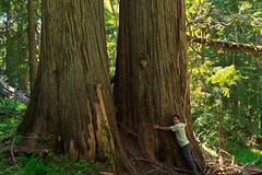
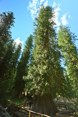
Walking Among Giants. This is a great place to bring the family. It’s a short walk from the parking area to the “mine” where $10 gets you the privilage to sift through dirt and sand looking for the prized star garnet. Emerald Creek is one of two places in the world to find star garnets, the other being a place in India. We came home with some nice garnet pieces and later in the week, took them to the local rock shop to have them looked at. Turns out, we had a couple of star garnets, one of which was nice enough to cut into a pendant. After rock hunting, I took everyone to the Hobo Cedar Grove to walk among the awesome forest and big trees.

Tuesday: We went to Spokane to shop and explore the city. After dropping a friend off at the airport, we headed to Manito Park where the botanical gardens are and finally got to see them in full bloom. Then we headed ot REI where Erin traded in her hiking boots for another pair that should hopefully be more comfortable. Surprisingly, I was good on this trip and didn’t buy anything. Then we went downtown to check it out. I was interested in Huppins, the local camera and electronics shop. I was disappointed to find they were more of a TV and stereo dealer than a camera shop. Looks like the nearest pro photography store might be in Seattle. We had dinner at Anthony’s, overlooking the falls and finished the evening with a walk through Riverside Park. Did I mention that we saw a moose on the way into the city?

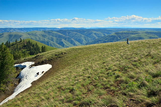
BeargrassWednesday: We had one “big” hike planned for the week, and for this trip, we kept it local and headed up to Freezeout Saddle. My initial goal was to hike to Lookout Mountain, but we ran into snow on the road that forced us to turn around and hike Grandmother Mountain instead. Last year, we hiked up there in early September and the area was showing signs of Autumn. Now, in late July, the area was showing signs of early Spring with tons of wildflowers in bloom including Beargrass! But what really surprised us was the ammount of snow up there so late in the season. I would expect a few patches here and there in some cool shady areas, but we were climbing over some good-sized mounds on the trail. The last push for the summit was nearly entirely on a snowfield under the trees. As a result, we stopped at Grandmother and did not continue to Grandfather Mountain on this trip. Nevertheless, that area is beautiful and quite awesome and a great place to go to beat the heat. I’m reminded that there’s such a short window to enjoy the high country between the time the snow melts enough to get up there and it becomes blocked off again by the next winter’s arrival.

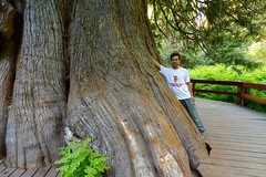
Me by the Giant Western Red CedarThursday: We can’t have visitors without taking them to Elk River. It’s such a neat place and so close that it’s impossible to pass up. We started at the Elk River Falls, hiking our usual route backward by starting at the lower falls and ending at the upper, giving the dogs a chance to swim in the pool below the upper falls before hiking back to the car. Then we stopped in the town itself to get some of their famous Huckleberry ice cream. Finally, we headed out to the giant cedar to show my dad… well… the giant cedar. Unfortunately, the road to the Morris Creek Cedar Grove has been closed all season for construction, so it looks like we’ll have to wait until next year to check it out.

Friday: We took a down day, spent the morning at home, and the afternoon in Moscow walking around town since most of the shops were closed on Sunday when we were in. We had one last nice dinner at Nectar and then headed to Lewiston where my parents were spending the night to catch a 5:30 am flight the next morning. And thus concludes a week of exploring the sights of the Moscow area.

Posted in All Things Moscow, Hikes, Personal Updates | Leave a comment

Stevens Lakes


Lower Stevens Lake

Lower Stevens Lake


The hike to Stevens Lakes itsn’t particularly hard, but it’s no walk in the park either. It’s about 2.5 miles and 1700 feet of vertical gain to the upper lake on a well-used and well-mantained trail. It starts off relatively steep and continues to climb steadily for the next mile before levelling out briefly as the trail emerges from a beautiful forest into an open basin surrounded by walls several hundred feet high. Just atop the headwall, 350 feet up, is the first lake, and Willow Creek drains from Lower Stevens Lake to drop over this ledge with a series of amazing waterfalls. It is at the bottom of this drop that the trail crosses the creek to start the mighty ascent and final approach to the lake. The old trail used to route you straight up the incline, but a new trail routes you along a series of switchbacks across a talus field, but on this July day, we were crossing a fairly significant snow field. As the trail came back with the old route, the final switchbacks were also snow covered, but the snow was soft and kicking steps was quite easy. We passed a view of the upper waterfall, a beautiful 30-40 ft. drop, before levelling out atop the wall. It was not long before the lake came into view along with a seriese of campsites along the northern shore.

I was surprised to see so much snow at sub-6000 foot elevations this late into July, but the upper lake, only a few hundred feet higher, was still mostly frozen over. There was a warm sun, cool breeze, and not a sound from the developed world despite the close proximity to a major interstate. We had only hiked in a little over 2 miles at this point, but it felt like the middle of the wilderness. I was also surprised at how pristine the forest was on this hike. The land closer to the interstate had been logged, and is still being used for timber harvesting, yet the Stevens Lake trail saw none of it. Along with the snow, it was still early spring up there. The Glacier Lillies, Trillium, and Forget-me-nots were in bloom all over the place, and on the lower sections of the trail, I finally saw some Beargrass in full bloom.

Stevens Lakes are a popular camping spot, and it’s not hard to see why. It’s so relaxing with beautiful scenery but not a huge effort to get there. On this day, there were at least 3 groups camping for the night. There are also a handful of sites by the upper lake, but they were stilI  burried under a couple feet of snow. In a few weeks, I may have to return and continue my hike up to Stevens Peak, an easy bushwhack to the ridge and a jaunt to the summit. I braved the snow and made it up to the upper lake for a few shots before turning back and descending to the car.

We finished the day with a dinner in Wallace.

There are many of these alpine lakes all over the mountains of the west. Many of them require long and strenuous hikes, but the reward is often worth it. But for families and non-hikers, the trip can be intimidating. Some of these lakes are accessible by car, but when you drive into one of these basins, you lose some of the magic and serenity. Some of the hikes are easy and require a difficult drive over primitive roads to start your hike in the high country. What makes Stevens Lakes so appealing is that it is easy to get to, right off of I-90, and the hike can be made for all levels. If you’re in shape, you can easily make it to the lakes in an hour and then continue up the ridges. If you’re slower, you can take all the time you want because it’s only 2 miles in. It’s a great way to spend a summer day and get to some great scenery.

View the Photo Album from this hike.


View Stevens Lakes Hike in a larger map


Posted in Hikes | Leave a comment

4th of July

Hobo Cedar Grove

The celebration of our nation’s independence is a custom dating back all the way to the day the Continental Congress approved and signed the Declaration of Independence. The use of fireworks to celebrate the momentous and historic occasion also dates back to that time. As John Adams wrote to his wife:

“The second day of July, 1776, will be the most memorable epoch in the history of America. I am apt to believe that it will be celebrated by succeeding generations as the great anniversary festival. It ought to be commemorated as the day of deliverance, by solemn acts of devotion to God Almighty. It ought to be solemnized with pomp and parade, with shows, games, sports, guns, bells, bonfires, and illuminations, from one end of this continent to the other, from this time forward forever more.”

Adams’ reference to the second of July marks the day that the Continental Congress approved a measure to declare independence. The official document, was signed two days later. Regardless, the founding fathers had visions that for years to come, that day would be memorialized with great celebration including the beloved fireworks display we have come to enjoy.

But while most people were celebrating America by blowing a part of it up, I chose a much more solemn way to pay tribute to this great country. We often remember our historical heritage during these days, but we sometimes forget about our natural heritage. On this day, I visited a grove of trees so old, they were standing tall long before the European settlers ever set foot upon the continent. These trees are a testament to the persistence of nature to thrive against the rugged challenges thrown at it. These trees have survived centuries of fire, drought, snow, and winds. And after all of the beatings, the trees still stand only to be taken down in mere hours by the hand of man.

Among the GiantsThere are few old-growth virgin timber stands left in the United States. When the settlers arrived, they quickly chopped down the forests for farm land, wood, and security. After all, much of Europe’s forests had already been decimated before the Americas were colonized, and the wilderness was a scary and dangerous place. But it also provided raw materials and natural resources with which to create new products and amass wealth. When the West was finally settled, the forests, with their big trees, were quickly taken advantage of. Fortunately, a few of the industrialists and businessmen who were responsible for the massive destruction of the landscape also recognized the importance of preserving some of it for generations to come. And for whatever reason, whether it be inaccessibility or the sheer awe struck by the people who saw them, some of these stands of forest were spared the wrath of the timber and mining industries and preserved for us to see today.

My 4th of July trip took me to the Hobo Cedar Grove and Botanical Area near the town of Clarkia, Idaho. The trees here aren’t the largest, but the forest is impressive. The one-mile walk through this patch of old-growth forest is enough to make you forget that you drove through a clear-cut to get there. At 4500 feet, it’s a great place to beat the heat. Temperatures on the Palouse were over 80 at mid-day, yet when I pulled into the parking area, the air was a pleasant 72. There is a picnic area and restroom at the trailhead, and a one-mile loop through some of the most beautiful forest I have ever seen. There is a shorter interpretive nature trail as well. The trail is well-maintained, though there were several downed trees across the path at this time. I suspect the maintenance occurs later in the summer. The drive to the grove is very scenic as well. From Clarkia, you drive along Merry Creek and then ascend into the mountains. While you do drive through a section of clear-cut forest, the clear-cut does open up views of the mountains to the west.

There are lots of other things to do in the area as well. You can continue driving to the St. Joe River, or take another turn back in Clarkia and head up to Freezeout Saddle. As of a few weeks ago, the road was drivable almost to the Grandfather Mountain trailhead. I imagine that if the road isn’t clear now, it will be in a week or two. Back down in Clarkia, you can search for fossils at the Fossil Bowl or head to the Emerald Creek Garnet Area, one of only two places in the world where you can find star garnets.

I am thankful that somebody had the foresight to preserve and protect the awesome beauty and splendor of our natural heritage, leaving us with great places for recreation and study. Oh, and in case you were wondering, yes, I did partake in the explosive celebrations later in the evening.

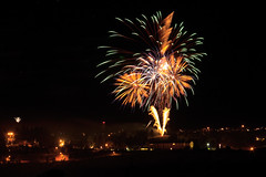
Fireworks Fireworks

Posted in Hikes | 1 Comment

Shoot for the Stars

Stargazing I

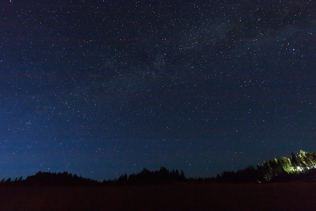
The night sky from my yard.

Last night, I had some folks over from the photo club for a little get together and fun. We grilled burgers, sat around the fire, and played with our cameras. We were mostly interested in shooting the night sky. I’ve shot the stars before, but last night might be my most successful attempt yet.

Stargazing IIShooting the night sky is rather difficult, but it can be quite rewarding. One can end up with an image with more stars in it than the eye can see. The problem is that stars are not very bright, so to capture enough light, you have to use a long shutter speed. Therein lies another problem: stars move in the sky. One solution is to expose for a very long time and capture the star trails. With digital photography, this is a somewhat difficult approach. For one, the sensor is using battery power to capture the image. So the longer the exposure, the more battery gets used. An all-night exposure is nearly impossible. Using film, you can open the shutter forever and not draw any power.

The other option is the “short” exposure, and by short, I mean keeping it to 30 seconds or less. Even at 30 seconds, we begin to notice movement in the stars, but it may not be so much to detract from the image. The images on this post were taken at 30 seconds, but you only see star movement if we blow the image up pretty big. There one last trade-off to consider. Do you want a night sky with lots of stars and milky way detail, or do you want your image to be crisp and sharp all around? To get lots of light, you need a large aperture, f/2.8 or larger. But while large apertures let in lots of light, they’re also difficult to focus and lenses aren’t usually their sharpest at their widest aperture. Stopping down can get you a crisper image, but you’ll only pick up the brightest stars. But with practice and lots of patience, you can have your cake and eat it too.

Posted in Photo Blog | Leave a comment

Upper Basin Trail


View Upper Basin Trail in a larger map

The Upper Basin Trail is a 5 mile loop in the upper basin of Elk Creek just north of Elk River The trail is near the giant western red cedar, thought to be the largest tree in the U.S. east of the Sierra-Cascade crest. The loop is also near the Morris Cedar Grove, another grove of large old-growth red cedar. unfortunately, the road to the Morris Grove was closed and blocked off on Saturday.

If you’re looking for a difficult challenge, the Upper Basin loop is not for you. The trail was built as an interpretative trail with markers along the way. The markers are just numbers and likely correspond to a brochure to carry with you, but there were no brochures to be found at the parking area. The trail itself is quite easy. The total elevation gain is about 400 feet and much of the trail runs along an old railroad grade which is flat and soft.

Giant Western Red Cedar

The Giant Red Cedar

The trail is scenic, but don’t come looking for grand vistas or picturesque stream scenes. Instead, it winds through some of the typical ecosystems in the area: logged forest (regrowth), marshes, meadows, and some more mature forest. I suspect that hiking this trail early in the morning would provide plenty of wildlife sightings. I passed numerous evidence of moose and elk and a few scat piles that may belong to wolf. This is definitely a trail that the whole family could enjoy and it seems to receive little use compared to the Elk River Falls and the Giant Tree, so it’s also a good way to escape the crowds. To get to the trailhead, travel to the town of Elk River, Idaho (Rt. 8 East from Moscow), turn left onto N. Front Street and stay straight on this road. It will eventually turn into a gravel road. At the fork, take the right Fork onto Forest Service Road 382 toward Upper Basin. In about 8 miles, turn Left onto a short spur that leads to the trailhead and parking area.
GPS coordinates: N46 53.075, W116 09.674
Clearwater National Forest trail #747

About 2 miles beyond is the giant Western Red Cedar. This tree is thought to be the largest tree east of the Cascades and Sierras. It measures 18 feet in diameter at breast height and measures 177 feet tall. It is estimated to be about 3000 years old. This short walk through an old-growth cedar grove is short and mostly handicap accessible, though not 100%. There is also a bathroom at the parking area. If you’re in the area, a trip to the tree is worth the visit.

Posted in Hikes | Leave a comment

Bad Ass Sunset

Kick-ass Sunset

Fire in the Sky

Last night was full of bad-assery. Yeah, that’s right, it was so bad-ass that I made up a word to describe it. After a cold spell, temperatures quickly rose into the 80’s yesterday making for a hot and somewhat muggy day. The conditions were ripe for evening thunderstorms. As I arrived home, I heard reports on the radio that there were some severe storms just west of Orofino. But looking around, all I saw was sunshine and blue skies. The storms were passing to the south of us. As I was washing my car, dark clouds crept in over the field to the south of us, but the skies overhead remained sunny. I heard thunder and the wind was picking up, but still the storms remained to the south. I checked the radar online and saw that Kendrick was getting hit, but we were in the clear for quite some time. I could still see lightning strikes over the horizon.

But then, everything became much more dramatic. The skies to the south began to glow orange, as if they were on fire. It wasn’t quite time for sunset yet, but then the fire spread to the rest of the sky. This was too good to miss, so I grabbed my camera and set up to shoot the sky with the best available foreground I had. The colors just got more and more intense, I caught glimpse of a rainbow in the distance but it was soon washed out by the glowing clouds. This whole time lightning was still striking in the distance and I thought, how bad-ass would it be if I captured a lightning strike in the midst of an already bad-ass sunset?

Unfortunately, I wasn’t quite that lucky. My exposures were reading 20 and 30 seconds, long enough for a lightning strike  to occur in the frame by chance, but after each shot, there was an equally long delay from the long exposure noise reduction. Often, this is when the lightning would strike. Just my luck. So when the intense colors faded, I was left with blue clouds over a green field and I decided to keep trying my luck at getting some lightning bolts on frame. Well, the lightning did strike, several times. I thought that lightning was so bright that it would pick up no matter what the exposure settings. I was wrong. After recording a few really nice strikes, I would review the picture only to find no sign of lightning at all. This is a skill I must perfect because when it does storm around here, it’s a pretty spectacular show.

The storm eventually moved on top of us and by then it would have been dark enough to capture lightning for sure, but I also wasn’t comfortable sitting out there with the camera. At some point during the night, everything had cleared and we had a great view of the stars. By morning, another storm cell had appeared on top of us, spitting down some good-sized chunks of hail. It seems that the storms have finally passed.

The result: It’s no longer a balmy 85 degrees out there, but a brisk 60. I had to wear a jacket to work today. Nevertheless, last night was bad-ass.
Posted in Personal Updates | 2 Comments

Kamiak Butte

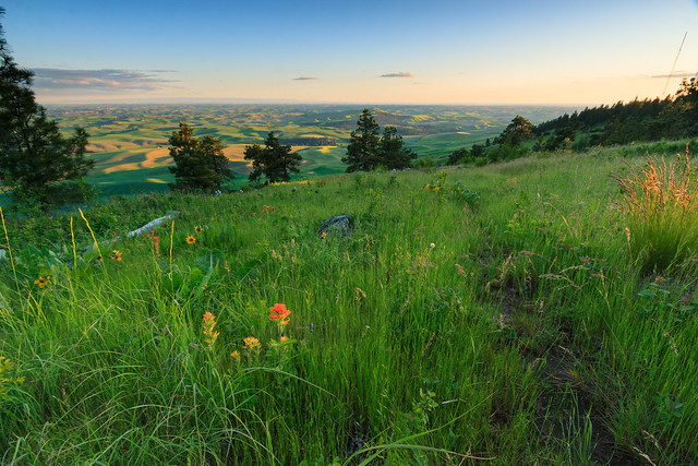
The Palouse, originally uploaded by Matthew Singer.

The Palouse is made up of rolling hills covered in wheat and barley fields. This area was historically a prairie, so there were few trees to begin with. A few of these hills rise up well above the rest, remnants of a time when the region was more active volcanically.
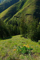
Kamiak Butte is one such high point, located less than 10 miles north of Pullman. The north slope is covered by a lush and beautiful forest, protected as a county park for all to enjoy. The park offers a picnic area, a campground, and miles of trails that ascend the butte and follow the ridge to the summit. There are views in all directions including views of both Pullman and Moscow. It’s a great little oasis amidst the sea of farmland. While it’s certainly not wilderness by any stretch of the imagination, it’s a great place to watch wildlife and look for flowers. On yesterday’s walk, I came across a Mountain Lady’s Slipper, but was unable to get a good photograph.

Kamiak Butte is a good place to get away and enjoy nature. It’s close to Moscow and Pullman and caters to everyone from families to the outdoor enthusiast.

Posted in All Things Moscow, Photo Blog | 1 Comment

Hells Canyon

This story begins with Luke and I itching to get out into the backcountry. Although it’s the middle of June, the combination of an unusually cold and wet Spring with the very productive winter has left many of the high country destinations (above 5000 ft.) still buried under 100+ inches of snow in places. And even some of the lower areas are still blocked with impassible snow drifts on the road. This makes our options quite limited.

The one place we’re sure to have access is Hells Canyon. With the river averaging 1200 ft. in between slopes that exceed 7000 feet, Hells Canyon is the deepest canyon in the United States. The Snake River cut a 200-mile ravine through a basalt plateau forming the western border of Idaho with Oregon. At under 1500 feet in elevation, the Snake River itself rarely sees snow and is warm enough for backpacking as early as March and as late as November. However, to get into the canyon, one must either float in from the town of Oxbow, OR or drive along windy roads over the 4500 ft. Pittsburg Saddle and down to Pittsburg Landing. While the road is plowed in the winter, the journey may still be treacherous to the casual traveler.

It is from Pittsburg Landing that we begin our hike. Our original plan had us hiking 31 miles in 3 days, ascending over 4000 feet out of the canyon from Kirkwood Ranch to Sawpit Saddle, and then returning to the Snake River via Sheep Creek on a trail that hasn’t been maintained in decades. It would have been an ambitious start to the hiking season. But we were unable to take 3 days for this, so we decided to tone it down and just stick to the Idaho Snake River Trail for about 10 miles or so, and hike back out the next day.

We began our hike huffing and puffing in the heat of mid-day. For a river trail, the Snake River Trail sure covers a lot of elevation gain. At our highest, I think we were 300 feet above the river.

Kirkwood Ranch is 5.5 miles south from the trail head. It was a working sheep farm back in the day, though as isolated as it is, it must have been tough living. Today, the ranch is a museum and ranger station. There’s also a backcountry campground on the old hayfield, though it offers such cushy amenities as flush toilets. We had planned to stop at Kirkwood for a late lunch break and then keep going, but we found out that the trail had been washed out less than a mile beyond and was rendered impassible. In fact, the “crowd” set up at the campground was mostly a trial crew in for a few weeks to repair the trail.

We had two options: We could take a detour, which entailed bushwhacking up and over a 2000-foot ridge to get back to the trail and keep going, or camp at Kirkwood and explore the area without packs. As we were already exhausted, the thought of climbing a steep incline with no trail and heavy packs only to be repeated the next day was not appealing. We found a spot, made camp, and went exploring.

Our destination Saturday evening was up the Kirkwood Trail, an ATV road that eventually led out of the canyon. We weren’t going that far, we headed up about a mile to Carter Mansion, and then up the hill looking for a vantage point. We were told that the views at the top of the ridge were first-rate, but the ascent would take about 3 hours. Tired and exhausted, we opted for a lower goal, a tree atop one of the landings on the way up. We made it within 200 vertical feet of the tree when Matt and I gave up and rested on a rock while Luke made way for the summit. When he returned, Matt decided to make a go for it. And when he returned, I felt as though I had to make my push for the top. So we all individually made it to our goal and then made our way back to camp for dinner.

I slept better than I had in a long while. I think we all did. We awoke refreshed and energetic with our eyes set on another high point just across the field from camp. It was a longer, and steeper climb, but we were rested and ready to go. We made it to the top, what was our top. The ridge kept going up. But from our “summit,” 1300 feet above camp, we had a glorious view over the Snake River. When we woke up and started, the skies were grey and overcast. It had actually rained during the night. But as we climbed that last push for the summit, the clouds broke and the sun came out.

Bushwhacking up a steep slope is actually the easy part. Coming back down is when there are more chances for injury. We took it slow and careful and eventually made it down to camp in one piece, though we were hurting. We rested, made lunch, refilled water, soaked our feet in the cold stream and packed up camp. Because we had made that climb, we set ourselves up to hike out in the heat of the afternoon, and there was no shortage of heat. The car read 83 degrees when we finally arrived back at the trailhead. The hike back wasn’t nearly as bad as the hike in, but we were still tired from the morning’s climb and it felt good to be back at the car.

The events that cut our trip short ended up making this a great first trip for the season. The summer temperatures in the canyon will make hiking along the river unbearable for the rest of the season, but we’ll have some chances to explore the high country as the snow melts and roads become accessible. Hells Canyon is a marvel of nature and worth a visit. The scenery is big and awe inspiring, and certainly humbling.


View Hells Canyon Hike in a larger map

Posted in Hikes | 1 Comment

Personal Updates

Lilac Gardens at Manito Park

It’s been an eventful week, and I should have posted more often, but I’ve been busy and tired and uninspired to write. So I’ll give you the update on the past week, and then some.

Last Monday was our actual anniversary, and even though we celebrated the week before with a getaway to Oregon, we still wanted to make the day special. We decided to drive up to Spokane, spend some time at REI, and have a nice dinner. For the longest time, I’ve been desiring a GPS unit for the trail, in part because trail maps for Idaho are scarce to none, and in part for the pure geekery that comes with having a GPS. I’ve always wanted to accurately map my route and overlay it on computer maps such as Google Earth, keep track of trip statistics, play with geographical data, and get into geocaching. Erin decided that her anniversary gift to me would be a GPS unit, so with the rather large dividend we earned from last year’s purchases, I got a Garmin Oregon 450t. Suffice to say, for the past week, I’ve been playing with it and having some fun. It’s nice because I can now feed back more detailed trip reports when I come back from a hike.

While in Spokane, I wanted to have a nice romantic evening at one of the scenic parks. We went to the botanical gardens at Menito Park and walked around for a bit. It was a lovely evening and the gardens were in bloom. We walked through the lilac garden and then through a section of native wildflowers. Unfortunately, we didn’t have much time to walk through all of the gardens, so a return trip is in store. Spokane has surprised me with its awesomeness: a big little city… or a little big city.

This weekend, we drove out to Elk River with the intent of hiking the North Basin Trail and stopping at the giant tree. To my surprise, the road was blocked with snow, despite being at less than 3000 in elevation. The snow line was definitely higher. I just wasn’t expecting the road to be impassible that low down. So, instead we played closer to town and let the dogs swim in the river. Rusty and Shadow flew in after a stick and floated 100 feet or so through a rapid before coming out. It was cute. We also found a few geocaches near town and then finished the day with a hike to Elk River Falls. It sure is different with the river flowing at full force.

I will finish with the story of our lawn. Back in April, we bought an old riding mower from someone in Orofino. Despite the age, it was in good working condition with a new engine and everything fixed up. In May, when the lawn had dried out some, I took it for a test and mowed a couple sections of the yard. In that time, the electric starter pooped out, though that’s not a big deal; it has a manual pull start that works just fine. I was able to mow the dry parts of the yard several times, but then a few weeks ago, the lawn mower just stopped working. I was in the middle of cutting the grass when it just shut off on me and I couldn’t get it started. So, unsure what the problem was, I put it in the garage until we could get it fixed. Problem is, we can’t take it anywhere because we don’t have a truck, and we couldn’t find anyone to come out and pick it up. So we decided to just eat the loss and buy a new one.

In the mean time, the lawn has gone almost a month without having been mowed, and it’s starting to look pretty wild. After doing some research, I went into Sears today and ordered us a new lawn tractor. Then I came home and decided to experiment. I was pretty sure that the engine was fine and I was beginning to suspect something wrong with the electrical system. So I jump-started the lawn mower. To my surprise, it started right up. So I spent the afternoon mowing down the jungle that had taken over the yard. It now looks respectable and once we rake up the clippings, I can go over it with another pass which will smooth everything out. I think I can finally have people over.

Posted in Personal Updates | Leave a comment

Weekend Getaway, Part III

View at 5-Mile Point

View of the Imnaha River Canyon from 5-Mile Point


Day 3: Canyons

Storm's Approachin'

Storms over the Wallowas

It’s a week later and I’m only now getting to the end of our romantic weekend away to celebrate our anniversary. Saturday was our third and final full day in Oregon. Thursday we had a nice scenic road trip to Enterprise. Friday, we explored the mountains. And Today (a week ago), we explored the canyons. Hells Canyon is a remarkable geologic feature. It’s deeper than the Grand Canyon, and on both sides it’s flanked by two major canyons. On the Idaho side, it’s the Salmon River with the Seven Devils creating the wall between the two. On the Oregon side, it’s the Imnaha river, separated by an extension of the plateau making up the Wallowa Valley. This formation between the two canyons rises up over 6000 feet in elevation and offers spectacular views on both sides. Unfortunately, we were unable to get over to the Snake River side at this time.

Our morning started out with breakfast outside again. I had a wonderful skillet with eggs and fresh local veggies. The sun was shining and the air was warm, but the forecast wasn’t to be so good for the rest of the day. Despite my best attempts to get out early, we still seemed to get a late start. The goal was to drive down to Imnaha and explore Hells Canyon a bit. Imnaha sits at the bottom of the Imnaha River canyon. At about 2000 feet, it’s often 10-20 degrees warmer and doesn’t get the harsh snows that the higher elevations receive. Thus, Imnaha was the winter refuge of choice for the Nez Perce.

Getting Closer

Storms in the Imnaha Canyon

Today, the town of Imnaha is the end of the paved road, 25 miles into the canyon from Joseph. There’s not much to the town: a tiny post office, a general store, and a couple of houses. But it is the gateway into the Hells Canyon National Recreation Area. We headed up the road to Hat Point, though Hat Point wasn’t our destination. My plan was to get up on the rim, hike around and find some views of the Snake River 5000 feet below. But our plan was thwarted 6-7 miles in when, at 5600 feet, we ran into snow blocking the road. The trip wasn’t without its merits. The entire drive up, the view over the Imnaha gorge just gets better and better. While we were up there, we watched as a thunderstorm developed over the Wallowas and were glad we weren’t over there. The rains slowly filled the canyon, but never actually fell upon us. Even as we drove back down into Imnaha, I was sure we’d hit the rains, but they passed before we got there.

We went back to Joseph for a late afternoon snack, and then back to the B&B for a bit. We had made reservations for a nice dinner at a place called Caldera’s in Joseph. Their menu is seasonal and the food made with fresh, local ingredients. The food was to die for.

Day 4: The Return Trip

Rattlesnake Grade

Rattlesnake Grade

All good things must come to an end. And so, Sunday, we got up early, packed, had breakfast, and headed back for home. Erin had to work, so we couldn’t make an exploratory drive out of it. We stopped at the Joseph Canyon overlook to use the restrooms, and we made one brief stop on the way down rattlesnake grade so that I could take a photo of the canyon.

It’s sad that the trip had to end so soon, but my days in the Wallowas are not over. I plan to make at least one trip there annually to do some hiking and backpacking. The Wallowas are a very awesome mountain range and their relative obscurity makes them that much more special.

Posted in Travel Stories | Leave a comment

Our Weekend Away, part II

Sacajawea, originally uploaded by Matthew Singer.

Day 2

Friday morning, I woke up in time to catch the sun rising over the Seven Devils. I went outside with the camera to catch the morning glow on the snow-capped peaks of the Wallowas as the sun rose in the sky. It was a beautiful morning, and quite warm, even at 6:00. We were told that it was the first time this season that breakfast was hosted outside.

Breakfast was amazing. Each breakfast starts out with fruit and yogurt with their own home-made granola. Erin had some toast from her bread. I was given crepes filled with a huckleberry sauce. Best crepes ever. The atmosphere helped. We were outside with a view of the mountains, the warm sun upon us, and the birds happily chirping all around.

Our plan was to visit the mountains. Our first stop was Hurricane Creek. Less than a mile in on a side trail, there is a rather large waterfall on Falls Creek. I was optimistic since there was no snow on the road or the trail. In fact, the snow line looked to be at least a thousand feet above us. However, when we got to the falls, we found the entire creek under feet of snow. But only the creek. It must have been avalanche build-up because the rest of the valley around was bone dry. In fact, the snow ended at the base of the falls. So we kept walking up the Hurricane Creek trail looking for a good view of Sacajawea.

Eventually, the sunshine and blue skies turned into dark clouds and threats of rain, so we turned back. As we got to the car, it started sprinkling on us, but not the heavy precipitation we were anticipating. We headed to Joseph and walked around town, finding a place for lunch. We drove along the lake and up to the Wallowa River trailhead where I wanted to hike to another waterfall, but as the weather never cleared, we decided not to. Instead we did some more scenic driving and scouted out a good sunset location. Unfortunately, the sunset was not too spectacular and we ended up calling it an early evening.

I finally got Erin into the Wallowa Mountains, and while we didn’t get very far, it was enough to show her why this place is special. I hope that she will muster up the energy to come all the way to the lakes district with me.

Posted in Travel Stories | Leave a comment