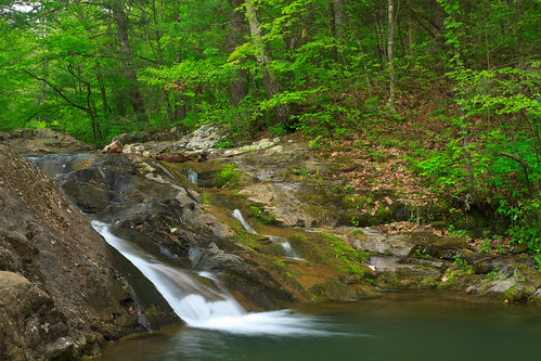
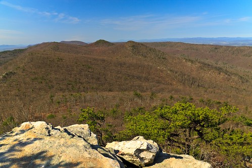
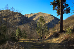
Old Rag


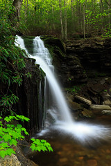
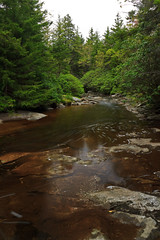
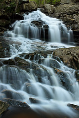
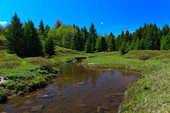
Spring!, originally uploaded by Matthew Singer.

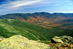
In April, I briefly lost my camera due to a bent pin in the card slot. I sent it to Canon for repair and got the camera back in a week’s time. Unfortunately, during that time, I had scheduled a hike up Old Rag with Jon, my supervisor at the time. So, after a trip to Fed Ex, I stopped at the camera store and bought a couple rolls of film.

I’ve finally had the chance to get the old scanner out of the box and get this set of slides scanned and uploaded. While I enjoyed shooting with film again and getting some nice rich contrast and tones, I am reminded of why I decided to go digital: I hate scanning. I’ve grown tired of it. Literally. I used to fall asleep waiting for scans to finish and then slog through the process of correcting the images, slowly as my aging desktop can only handle about 4 photos open in Photoshop at a time. Color balancing is a pain because it’s not the same as a temperature white balance performed on RAW files. And then there’s the search for and fixing defects, scratches and specks on the film that the digital ICE either didn’t pick up or did a bad job of removing. It’s all time consuming, but not in the therapeutic sense that the tedious work in a darkroom is. No, sitting in front of a computer screen takes its toll.

I’m sure I’ll have some rolls of film to shoot in the future, but for now it’s primarily Digital again. So enjoy the last set of film for a while, as well as the last set from the East until I can afford to get back there.

Posted in Hikes, Photo Blog | Leave a comment

Oregon


Sunrise, originally uploaded by Matthew Singer.

I made my very first appearance in the state of Oregon over the weekend. I’m impressed and hooked.

Oregon is a very pretty state, and I didn’t even get to see very much of it. My Oregon experience took me to a little known section in the northeastern corner, the Eagle Cap Wilderness Area in the Wallowa Mountains.

I went with two other grad students in the department for an overnight trip to Mirror Lake in the heart of the wilderness area. We left Friday night just as the sun was setting and drove pretty much all of the drive in the dark. Thus we had no idea what we were driving through when the road became extremely twisty dropping in elevation and then rising back up. I knew there was a canyon to cross, but it wasn’t until we returned on Sunday that we could see just what it was. We stopped for a late dinner at Subway in Enterprise and car camped at a site off of Lostine River Road.

From the trailhead at the end of Lostine River Road, the hike was 7.5 miles gaining 2000 feet to the lake at 7600 feet above sea level. We gained 3/4 of the elevation in the first three miles. The next three miles were bliss, a flat trail through an open meadow wandering down a glacial U-shaped valley. It was here that we caught our first glimpse of our destination. Eagle Cap, the 9575 ft. summit, looms in the distance, but our lake lies right at its base. It is a magnificent sight.

The hike to Mirror Lake is one of the most popular in the Wallowas. The trail is well defined from heavy use and campsites were quickly taken, but there are tons of camping options so finding a place to sleep wasn’t too difficult.

We relaxed, explored the lake, and watched the sunset before making dinner and retiring to our tents for the night. Because the area is so far removed from any major cities and towns, the sky was dark and full of stars. I attempted to capture the sky before heading off to bed.

I woke up the next morning just as the light was gathering, bundled up and headed to the lakeside with my camera. I set up to catch the morning alpenglow as the pink light illuminated the summit of Eagle Cap. It was glorious.

We returned the way we came, nixing the loop over the ridge to the next lake and down the neighboring valley back to the car. I hope to return to make it to the summit of Ealge Cap and explore more of this heaven on earth.

Sunset on Eagle CapPetes Point

Posted in Hikes | Leave a comment

Grandmother Mountain

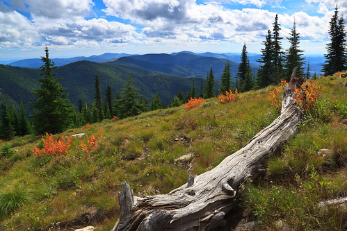
This weekend, Erin and I set out for our first hike together in Idaho and we made our first summit together on Grandmother Mountain. The hike to Grandmother Mountain begins high up in the St. Joe National Forest 12 miles out of Clarkia. The entire hike is above 5500 feet, which was a neat considering all of our hiking in the East (so far) was under 5500 feet.*

Grandmother Mountain is an easy two-mile one-way along a high sub-alpine ridge with forest mixed with meadow. The summit stands at 6369 feet above sea level and offers a spectacular view over the St. Joe river valley, though the approach to the summit offers spectacular views in all other directions. Add another two miles to get to Grandfather Mountain at 6306 feet. We intended to get to Grandfather Mountain, but got a late start and were slowed down by a sweet surprise along the way. Nevertheless, whether you do the 8-mile or the 4-mile hike, this is a really awesome place to spend a day.

Fall comes early in the high elevations of the northwest. The huckleberry and many other bushes are already displaying their bright colors. But, to our great surprise, the huckleberry bushes still had a plethora of ripe berries to forage upon. The berries up there are small, but pack a punch. Erin likes them better than our blueberries on the Appalachian ridges. On the way back, we stopped in the saddle to enjoy the sunshine and collect about a cup of berries to take home and bake with.

* I’ve hiked above 6000 in New Hampshire and Tennessee/North Carolina, but not with Erin. While Mount Rogers tops out around 5700 ft, we’ve never actually gone to the summit. White Top summit and Thomas Knob/Wilburn Ridge are around 5500ft.

Posted in Hikes | Leave a comment

Fall Foliage

Foliage, originally uploaded by Matthew Singer.

With the sudden drop in temperatures, Fall has officially begun in the northwest. This is the first time I’ve spent fall in a predominantly evergreen forest. While there is color to be found in the west, I suspect that the immediate area won’t be the place to find it. But, as fall rolls in, I provide a tribute to the spectacular display before the forest retires for winter.

Maple FoliageWildcat Mountain
Snowy Skyline DriveBarn and Foliage

Posted in Photo Blog | Leave a comment

Hiking Deary


View from Potato Hill, originally uploaded by Matthew Singer.

I’ve now been in Idaho for almost three weeks and I’m starting to get settled into my new home. Later I will post about the property and the abundant wildlife that make our place so special.

But today, I write about a local hiking opportunity just over a mile down the road in the town of Deary. I have a theory that all cities and towns have an overlook, a spot from which you can stand and look down upon the population center. Sometimes these overlooks are only a few feet above the town itself. Sometimes they are man-made structures. But in mountainous and hilly regions, the overlook is most certainly a natural feature seen from the town itself. Of course there are many exceptions to this rule, but I find in most of the places I’ve been that the rule stands strong. In some cases, you can simply drive up to the overlook. In others, you can hike. And in rare circumstances, you have to bushwhack or even tresspass on private property to get there.

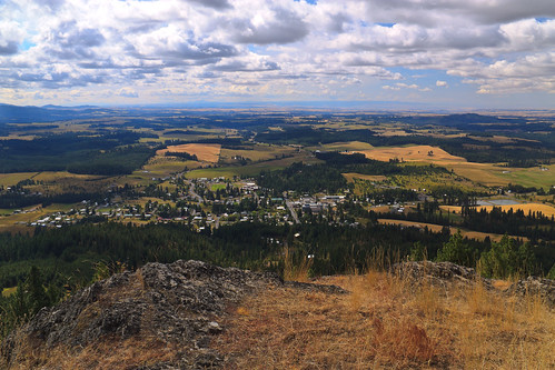
Deary is no exception to the rule. Just behind the town to the north stands a hill a thousand feet above with a break in the trees and some cliffs on the summit. When I first drove through Deary in February, I wondered if the land was public property and if there was a way to the top. I now revel in the fact that the answer to both questions is “yes.”

The trail up Potato Hill is designated a restricted use road available for all modes of transportation except automobile. So I was expecting to pass a few people on ATV’s or even horseback, but during my hike today, I passed only one person, and he was hiking with his dog just like I was.

It’s two miles and about 1200 vertical feet from the town center in Deary. About half way up, the road ends at a communication tower and the trail becomes, well, more trail-like. In fact, there was hardly any signs of recent ATV use, so I suppose most people hike to the summit if many people go up there at all. The trail winds through an mix of open forest and grassy meadow and has a great prospect for wildlife sightings. As you increase in elevation, the slope becomes steeper and the forest becomes denser, when suddenly the forest breaks altogether and a series of cliffs open up a view over the Palouse. The hike is pretty mellow until the last jaunt to the summit where the trail turns straight up and becomes populated with loose rock.

Nevertheless, the view from the summit is exquisite. The town of Deary, population 500-something, lies just below to the South. Beyond is the mix of forest and field of the eastern Palouse. To the West, you gaze upon Moscow Mountain and watch as the Palouse suddenly ends with a series of canyons off in the distance. Below, but out of sight, is the Clearwater River and the city of Lewiston. To the east, mountains rise and get bigger with each layer.

This is a short hike, easily achieved in less than half a day, but nice to have so close to home. And yes, there are bigger mountains with taller views, those will be explored in due time. But this looks to be my go-to hike when I’m too busy to go farther afield.

Posted in Hikes | Leave a comment

The Road Trip

Well, we are finally off and on our way to a new life in the middle of nowhere, Idaho. Of course, this trip is not without its share of stories.

To begin with, we were supposed to leave Maryland as soon as Erin was done with camp. I gave her until 2:00 and we were pretty much packed and ready to go by 3:00. We locked the cats in the bedroom so we wouldn’t have to go looking for them, but they knew something was up and were trying their best to escape. Pumpkin got out several times, but we always managed to catch him and bring him back. But when Erin went up to the bedroom to pack the final items, Pumpkin escaped, ran downstairs and then back up. And then he disappeared. We searched all the rooms on the third floor and found no sign of him. There was a possible sighting of him running outside, so maybe he ran back down without notice. Erin wouldn’t leave without Pumpkin, so we were stuck at the farm waiting for him to show up. We were prepared to spend the night, hoping he would come back in for his can of wet food.

So we waited, and waited, and searched all over the farm with no sign of the little furball. It was near 8:00 when Erin was in the bathroom on our floor and heard a squeaking in the wall. Sure enough, Pumpkin had run upstairs and vanished, just as I originally suspected. He had run into the bathroom closet, which has a huge gaping hole in the wall, and managed to hide within the walls of the house for the entire afternoon. So, with time to spare, we decided to load all the animals into the car and get a head start on our journey. We made it to Mars, PA, just north of Pittsburgh.

We had a long and fairly uneventful drive on Saturday involving five states. We drove all the way from Mars, PA to Waterloo, IA, pulling in after midnight because the Motel 6 in Dubuque was completely full.

Yesterday, we drove a record 800 miles from Waterloo, IA to Gillette, WY driving through Minnesota and the entire length of South Dakota. To break up the drive, we took a detour off the interstate to drive through the Badlands National Park. Somehow, the vast and endless prairie is abruptly broken with a series of desert-like sandy cliffs that are eroded into canyons and neat formations and have earned the reputation of the Badlands. We stopped at some overlooks, made it to the visitor center before it closed, and continued through the park. We made it a little ways down the road and stopped to walk the fossil trail. We have to leave the car running so that the animals don’t get too hot, but we’re never far from the car anyway. We get back and the doors are locked. The dogs must have knocked the button and subsequently stranded us outside the car. In our infinite wisdom, our cell phones and spare keys were inside the car. Great!

Another visitor let us borrow his phone to call AAA. Now the Badlands aren’t really near anything. There are a few small (and I mean small) towns at the entrances, but the nearest major population center is Rapid City, about an hour away. But within a half an hour, AAA had someone out to get the doors open. Meanwhile, we had missed sunset and drove the rest of the park in the dark.

We were tired and ready to quit for the night, and Rapid City was a good place to stop. But it turns out, there is a massive biker convention going on this week and all hotels were booked. The next Motel 6 was 2 hours farther in Gillette, WY. I would have camped, but Erin wanted to be able to let the cats out to roam around freely, so Gillette it was. Here we are in Wyoming getting ready to head for our next destination, Missoula, MT. Since we have a shorter drive, we should be able to get in at a reasonable hour and maybe even stop to see things along the way.


View Larger Map

Posted in Travel Stories | Leave a comment

Kittens


I can hidez., originally uploaded by Matthew Singer.

We’ve been in and out of the Altoona area to pack up belongings in preparation for the big move later this summer. We usually stay with Erin’s grandfather who lives on a farm off of Rt. 22 near Williamsburg. He has some “stray” cats that he feeds, but won’t get spayed or neutered, so every so often we find a litter of kittens.

Two weeks ago, we were visiting and the kittens were out playing. I couldn’t resist a photo shoot. As cute as they are, we are not keeping any of them. We already have five and that’s more than enough, but I’m sure we could find them a good home.

Anyone want a kitten?

Posted in Personal Updates | Leave a comment

Dolly Sods, Revisited

Dolly Sods Meadow, originally uploaded by Matthew Singer.

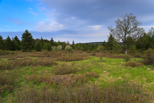
In the fall, I visited West Virginia’s Dolly Sods with my parents. The foliage on the blueberry bushes was amazing, but the trees had not yet turned. I was planning to return a week later to backpack through the wilderness area during its peak foliage, but my car broke down and I was unable to make the journey. So I decided I’d make a spring visit instead.

So, a week and a half ago, I did just that. I got together with Charlie (uvagolfer), another hiker and photographer I met on Flickr, and we did a one-night backpacking trip into the heart of the Dolly Sods Wilderness. We planned a route to cover all imaginable terrain, the northern high country along Blackbird Knob, the scenic views of Rocky Point, and the waterfalls and river terrain of the bottom of Red Creek.

Our initial plan was to hike in from Red Creek Campground along the Blackbird Knob trail, turn down the Red Creek Trail and camp behind the rocks at Rocky Point, then head up Big Stonecoal Creek and return the whole length of the Blackbird Knob Trail. But we had to change our plan when we found no suitable camping at Rocky Point. In fact, when we got to Rocky Point, we couldn’t find the cliffs initially. The trail comes out on a talus slope offering a small view over Stonecoal gorge, but nothing spectacular. On our way out, we found an unofficial side trail blazed with cairns and decided to follow it. Sure enough, it led to the top of an amazing rock outcropping showing off views up and down Red Creek Canyon. We had the evening light to shoot, but had to return to the trail before it got too dark.

When we reached the intersection of the Rocky Point and Big Stonecoal Run trails and had to make a decision: head upstream a little bit where the terrain flattens out and there might be a campsite at the stream crossing, or head down a steep 1.2 mile trail to Red Creek where we knew there was a campsite. We chose to go up, and it’s a good thing we did. Almost immediately after the intersection, we found the big waterfall on Big Stonecoal Run and had some time to shoot some long exposures in the dark light. We found an awesome campsite among the spruce forest next to the stream.

The next morning, we had to decide wither to continue on our planned route, or head down to Red Creek and circle back up the Red Creek Trail. It was a gray and cloudy day, and there were supposed to be more waterfalls below us. Had it been sunny, the scenic views and meadows would have been a better option, but we chose to go down and were not disappointed. We hit two more nice cascades on Big Stonecoal Run before hitting Red Creek. There were two gorgeous waterfalls on some side tributaries on the Red Creek Trail, and two more small, but wide drops on Red Creek itself. So, what should have taken us a few hours to hike ended up taking all day. We returned to the car just as the evening light was fading away.

There are some really awesome campsites in the Dolly Sods, some big enough to be called campgrounds. The first we came to was an island on Red Creek along the Blackbird Knob Trail. The island was mostly flat and grassy with a small patch of hemlock and spruce. Surrounded by water, it would have been a very serene place to stay. The second was at the confluence of Left Fork and Red Creek. Here, and area was cleared and grassy with room for lots of tents. In fact, a big group was using it that night. That site was probably once a homestead or a mining camp as there was once a railroad bed leading to it. The third big site was at the confluence of Big Stonecoal Run and Red Creek, another grassy area with 4 fire pits and lots of space to pitch tents. Of course there were some smaller, more private sites along the trails as well.

The Dolly Sods is possibly one of the most beautiful spot in the mid-atlantic, easily topping anything Virginia has, except maybe Mount Rogers. But the terrain and scenery at the Dolly Sods wouldn’t exist if it weren’t for its land use history. Regardless, the protection of this land as a wilderness area makes it a great reason to visit West Virginia. There are some other spots in the Monongahela that I hope to get to before I leave, but time is limited.

Yet Another Waterfall, Pt. 3Big Stonecoal CreekThe Waterfall on Big Stonecoal Run
Left ForkRed Creek Gorge from Rocky Point

Posted in Hikes | Leave a comment

Mother’s Day

Hazeltop, originally uploaded by Matthew Singer.

This past weekend, my mom came to Luray to visit me. We spent Saturday in town at the annual Festival of Spring. Main Street is shut down to traffic and the stores and other vendors set up shop on the street. We spent a good deal of time at the wine tasting area, where there ten or so local wineries set up with their products to taste. I tried everything. There were your traditional wines, Chardonet, Merlot, Shiraz, etc. And there were some new ones, wines made from fruits other than grapes, one made with hot peppers, and even a wine made with chocolate.

The other highlight of the day was the dog frisbee competition. Sandy entered Bizzy, who just couldn’t compete with the seasoned veterans. They did win 2nd in the free-style event. I didn’t even bother to enter Shadow. She was uninterested in the discs, but she was happy to watch all the other dogs.

Sunday, we went for a hike in the national park. I chose a nice 7-mile loop over Hazeltop, then down to Rapidan Camp and back to Skyline Drive. It was a bit cold out, but the weather was perfect. Spring had just hit the upper elevations, and many trees still had yet to produce their leaves. There were lots of Large-flowered Trillium and Wood Anemone along the Appalachian Trail. On the Laurel Prong Trail, we ran into a patch of Pink Lady’s Slippers, and later we found the elusive Showy Orchid.

Rapidan Camp was Herbert Hoover’s version of Camp David, a Presidential retreat to get away from the hustle and bustle of Washington, D.C. The camp is located at the confluence of the Laurel Prong and Mill Prong where they form the Rapidan River. All that remains are the Brown House (president’s house), the Prime Minister’s Cabin for distinguished guests, and the Creel Cabin, currently used to occupy park service staff. There are exhibits set up in the other two buildings, but neither were open at the time. We did sit on the back porch of the Brown House to eat lunch and enjoy the relaxing atmosphere of the camp. We returned back to Skyline Drive by way of the Mill Prong Trail, stopping at Big Rock Falls for a photography break.

Posted in Hikes | Leave a comment

Swimming Holes

When the weather turns hot and humid, there’s no better way to stay cool than at your local swimming hole. Swimming holes offer something that your pool does not: privacy, seclusion, crisp cold water, and no chemicals. That icy mountain stream gets the old heart moving at first, but feels refreshing when the air temperature passes 90 degrees.

At camp, we have two swimming holes. We frequently take kids to one along Jeremy’s Run because we can walk there. Jeremy’s Run is nice. There’s an upper pool with a slide down to a lower pool. But occasionally we’ll take special groups to Overall Run which has a faster slide, a deeper pool, and a small jumping rock.

This weekend, I had the pleasure of swimming in both. It was Family Weekend here at the Mountain Campus, and on Saturday, I lead a wildflower hike along Jeremy’s Run. With the hot weather, we stopped at the swimming hole. I don’t usually get in during program hikes, but I was roasting. The swim felt good. Today, after everyone left, I went to Overall Run with Megan and Huck. Shadow and Bizzy came along as well. Initially, the rest of the staff was going to come, but they pooped out and missed a great time. Megan left early and I stayed behind to photograph the waterfalls.

Swimming holes can be a lot of fun, but there are some precautions you should take to keep you and the hole safe. If the water is not clear, you should always test the depth before jumping off a rock or sliding down a waterfall. Watch out for strong currents and undercut rocks, especially in large rivers. Remember that you are entering a natural ecosystem. Be careful with chemical substances like bug spray and sunscreen. It’s best not to use them when swimming in a stream. Check out the inhabitants of the stream. Turning over rocks will reveal a world of creatures you probably had no idea were there. An abundance of Stonefly and Mayfly nymphs and Caddisfly larvae are a good indication of good water quality and a healthy stream. Swimming holes are natures own water parks, and they can be more fun than our man-made ones.

Posted in Hikes, Travel Stories | Leave a comment

Big Falls on Overall Run

Big Falls on Overall Run, originally uploaded by Matthew Singer.

It’s great to have my camera back. Two weeks ago, I bent a pin in the card slot which rendered the camera useless. After speaking with Canon support, I packed up the body and shipped it off to the nearest repair facility. It left FedEx that Monday and arrived at Canon on Wednesday. I authorized the repair and it was fixed on Thursday and shipped back on Friday. I received my camera on Friday. While I’m not happy to shell out the expense of fixing my equipment, I am very pleased at the speed and helpfulness of Canon’s support and repair.

In the weekend I didn’t have my camera, I hiked up Old Rag in Shenandoah National Park, which has the best views around. I brought my old EOS 3 and a roll of Kodak E100GX with me. Two weeks later, I still haven’t gotten the roll developed. Of course, it doesn’t help that I forgot to bring it to Maryland with me this weekend.

Monday and Tuesday we were on an overnight canoe trip with the most gorgeous weather. I left my camera behind until I get a good dry box to port my gear in. But Tuesday evening, I headed into the park to find the big falls on Overall Run. The 93 foot waterfall is the highest in Shenandoah National Park, but it also tends to run nearly dry in the summer. A few weeks ago, the falls would have been raging, but the peak Spring greenery made this week the perfect time to look for the falls.

I found it easy enough. After 3 miles of down-hill, the trail opens up atop a cliff with a great view of the valley and a great view of the Big Falls. There are a few other notable cascades before the big plunge and I’m sure there are some more after. At the bottom of the mountain, Overall Run has a nice water slide and swimming hole, easily accessible by the Thompson Hollow Trail.

I’m glad I have my camera back and I’ll surely be careful not to damage it again. There are so many places left in the area that I wish to visit, and my time is dwindling before I leave Virginia for Idaho.

Posted in Hikes | Leave a comment

Duncan Knob

View on Duncan Knob, originally uploaded by Matthew Singer.

I got up early this morning to hike before the heat of the day. I would have liked to have gotten up earlier to be at the summit for that early light, but I enjoyed what I got.

I arrived at my trailhead by 8:00 and reached the summit of Duncan Knob a little after 10 and I had the trail and the rocks to myself. I basked in the sunshine and enjoyed the view for almost an hour before heading back. When I got back on the Gap Creek Trail, I heard voices. I had to do a double take, but sure enough, there were people heading up. I guess I got there and left at the right time. Two pair of people passed me, and my perception of solitude was shattered. Oh well, they were headed up and I was headed down, I could still have the rest of the hike to myself, right?

For the most part, that was true. But as I drew nearer to the parking area, I passed a lone backpacker and then a group of 3 women and another family of 3. But by that time, I was minutes from the car. I guess I wasn’t the only one who thought Easter was a good day to take a hike.

Posted in Hikes | Leave a comment

Life at Camp

I haven’t been very good at updating this or my livejournal in a while. I’ve been fairly busy for the past few weeks. I returned to my job at the mountain campus (www.mountaincampus.org, check us out) in the middle of March and spent the first two weeks cleaning up and preparing for the season. With all of the heavy snow this winter, we had a fair number of trees fall in critical places, so we spent the better part of a week removing some of them. It’s been so wet, though, that we can’t get to all of them with the truck yet, so there are still many downed trees remaining. We also got all of the tents set up and the buildings deep-cleaned so they would be presentable for a summer camp open house.

Last Friday, Steve and I went camping at Hone Quarry outside of Harrisonburg. The Forest Service campground is small and rustic, and nestled in a deep hollow of Shenandoah Mountain. It’s a beautiful spot that feels isolated even though it’s fairly close to civilization. It’s also not very crowded in the off season. We managed to choose the coldest night to camp. Temperatures dropped down to about 25 degrees Fahrenheit, which is the comfort limit of my 20 degree sleeping bag. It’s good to know the insulation survived the washing machine. In the morning, we hiked the short trail to a rock overlook and then tried to drive to Reddish Knob, but at 4300 feet, the road still had some snow drifts near the summit that were not going to fare well with my car. We headed down the mountain and went to Second Mountain for an afternoon of bouldering.

Last weekend, the new staff arrived for the start of training. We’ve been teaching them the ropes (literally) while playing on the elements and getting them set up for the new season. Training continues next week and we’ll get our first school group the week after. Here are a few photos documenting our fun. Continue reading

Posted in Personal Updates | Leave a comment

Asotin Creek


The Deep Gorge

Originally uploaded by Matthew Singer

While we were out in Idaho, we had the pleasure of taking a day and hiking. While the Moscow area was devoid of any snow this year, the surrounding mountains still had a bit of the white stuff, and forget about trying to get to the big mountains. It was winter, after all. I’m particularly excited about the nearly year-round hiking available out there. In the summer, I can retreat to the high country. In the winter, I can head low into the canyons where it stays pretty warm late into the fall and warms up quickly in the spring.

Hell’s canyon was a bit far for this trip and may have required driving on some snowy forest service roads in the higher altitude. But as I soon found out, there’s plenty of good terrain closer to “home.” Just south of Lewiston on the Washington side of the Snake River is Asotin Creek. The creek begins in the Blue Mountains and winds its way down to the Snake, carving a deep gorge up to 1500 feet deep in many places.

Unlike the canyons of the southwest, these are carved into Basalt in a slightly less-dry environment. The result is more vegetation, though it’s still mostly grasses and shrubs. There are small patches of evergreen forest on the canyon floor, particularly on the northern walls.

The drive in to the trailhead seemed to take forever, at least 20 minutes on a dirt road. At one point, I thought we’d be at the head of the canyon, not very deep below the rim. But upon further investigation, I found that the trailhead in the state wildlife management area wasn’t even halfway up the gorge. We ended up only hiking about two miles in, but I’m already hooked. I’m looking forward to returning and hiking beyond our stopping point, maybe even spending a night or two down there.

But more importantly, this sets the tone for exploring Hell’s Canyon, a gorge deeper than the Grand Canyon.

Asotin Creek Canyon Asotin Creek Canyon
Asotin creek Canyon Asotin Creek

Posted in Hikes, Travel Stories | 3 Comments

Heading West


The Palouse, originally uploaded by Matthew Singer.

Holy Smokes, it’s March already? My how time flies. It’s funny how time goes by when life is mundane and you feel like you’ve wasted the days. On the other hand, when you’ve got something to look forward to, it just can’t come fast enough.

I suppose I ought to let you, my readers, up to speed on my future. In January, I received a notice of acceptance to the University of Idaho. So last week, Erin and I went out that way to visit the school and the area. Long story short, we love it out there. We even found a house with a barn and riding ring that we like and should be able to afford. While I still have outstanding applications at a few other schools, we are more than 90% sure that come August, I will be a Ph.D. student in Idaho.

Idaho? What’s there? I thought it was a big hole in the ground. Go ahead, crack all those jokes. Idaho is a huge state with a population that barely exceeds one million. Much of the state is extremely conservative, people who are very Christian and have the “government should stay out of our lives” mentality of the west. Guns, God, and no Government. It’s sickeningly amusing. But Moscow is an anomaly, a spot of dark blue in a sea of blood red. Moscow is extremely liberal and progressive. I noticed only two car dealerships in town and one specializes in Subaru. Moscow is all about keeping it local. Buy locally grown organic food from the Co-Op. Buy locally made merchandise from any of the shops downtown. Or just support a small, locally owned family business including a book store, game shop, outdoor gear shop, two pet stores, and the list goes on. Moscow is like a very miniature Portland, Maine.

The part about northern Idaho that I really like is the abundance of recreation opportunities. Just outside of town is Moscow Mountain, covered in trails and a mix of private and public land. Hop up to an hour away toward Lewiston for some canyons to explore. Extend your drive to up to 3 hours and you’ve got some big mountains and sweet roadless wilderness areas. To the north is Couer d’Alene, the I-90 corridor, some big lakes and ski areas. To the south is Idaho’s Seven Devil’s Wilderness, to the southwest is Hell’s Canyon (deeper than the Grand Canyon) and Oregon’s Eagle Cap Wilderness, to the east is the Bitterroot range. And for longer trips, Glacier, Mt. Rainier, North Cascades, and Olympic Naitonal Parks are all withing driving range. There’s world class white water rafting on the Snake, Salmon, and Clearwater rivers. And when I need some city culture, Spokane is less than 2 hours away and Seattle and Portland are less than 5 hours away.

I’m ready to move out there and explore some new terrain.

Posted in Personal Updates | 2 Comments

Photographing Birds on the Farm

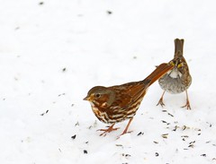
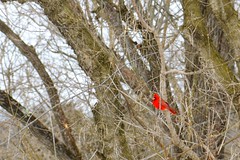
Fox Sparrow Fox sparrow Passerella iliaca White-crowned Sparrow White-crowned sparrow Zonotrichia leucophrys Northern Cardinal Northern cardinal Cardinalis cardinalis Today I took the camera out to photograph the birds. We’ve got a feeder in the front yard, but all the birds flock to the seed spilled on the ground. So I threw the dogs inside, scattered a can of seed on the ground, sat and waited. It didn’t take long for the birds to come in. Around the farm, I’ve been mostly seeing the usual winter birds: Cardinals, Chickadees, Titmice, Carolina Wren, Junco, Song Sparrow, White-throated Sparrow, and some non-feeder birds: American Crow, Raven, Black and Turkey Vultures, Red-tail Hawk, Belted Kingfisher, Eastern Bluebird, American Robin, Yellow-rumped Warbler, Northern Flicker, and so forth.

During today’s photo shoot, I discovered that we have more sparrows on property than I originally thought. While going through the pictures, I identified Fox Sparrow and White-crowned Sparrow, both of which are uncommon according to the Sibley field guide.

If I learned anything from this photo session, it’s that my lens, the Canon EF-s 18-200 is not very good on the long end. The images are surprisingly sharp, but Chromatic Aberration is difficult to work with, Autofocus is inaccurate much of the time, and it’s really just not long enough for photographing small birds. Someday, I will have a Canon 100-400. But at least this lens is better than my old 70-300.

Posted in Personal Updates | 1 Comment

National Aquarium in Baltimore

Last Saturday, Erin had to go to Towson to take her riding instructor exam. I dropped her off at Goucher College and headed to REI, only to find that they didn’t open for another hour, so I drove down the road to Borders, looked at books I couldn’t afford, and played on the reliable fast internet for a while. It’s funny, when I went into the the store at 9:30, there were barely any cars in the parking lot. When I left at 11:00, the lot was full. I did make it back to REI to play with gear, but Erin called to say she was finished early, so I drove back to the college and picked her up.

We returned to REI so I could exchange my shoes, which had blown out way before their time, and get a new pair. Then, with the whole afternoon ahead of us, we drove into Baltimore. Against my better judgment, we decided to go to the Aquarium. I’ve been wanting to go back ever since I discovered the new addition with the Australia exhibit. It turns out a lot has changed since my last visit in high school. They no longer have Beluga whales, only dolphins. The baby sharks in the old Beluga pool have grown up to be bigger sharks. The deep-sea tanks have become night reef exhibits. The jellyfish have moved to the dolphin pavilion for their own “Invasion of the Jellies” exhibit. The touch tank has been removed altogether. And, of course, the new Australia, which was awesome.

If you’ve never been to the aquarium in Baltimore, it’s worth a visit. Once you enter the aquarium, you’re brought to a big pool, pictured above. Long ago, this used to be where the Belugas lived and performed their shows. But that was a loooong time ago. Since they moved to the bigger amphitheater across the pier, this pool has been used to house small sharks, rays, sea turtles, and open-water fish. It’s kinda sterile, though. I wish they’d add some decoration to make it look more habitat-like. I think it’d make a great Chesapeake Bay exhibit.

From there, you move upstairs for three floors of small-tank exhibits surrounding the big tank. From each floor, you can always look down on the sharks and rays, but you’re mostly too busy enjoying the other fish. From the 4th floor, you rise one more level into the glass pyramid of the Amazon rainforest. This is my favorite part of the entire aquarium. In truth, rainforest exhibits are my favorite part of any zoo or aquarium. They generally exhibit live plants, free-flight birds, other animals, like primates and turtles, a flowing stream with a glass edge to look in, smaller tropical animals in their own habitats (frogs, snakes, lizards, small mammals…). But the birds are what make it. I love the warm, humid atmosphere with all the sunlight and the sounds of the birds.

Coming down from the rainforest, you are perched atop the giant reef tank. The reef is an oval, 15-20 feet deep, and you walk down the middle. Under the reef are the sharks, and under the sharks is the under water viewing area for the big tank we saw at the very beginning. You can see the window in the photo above. From there, an escalator brings you back up to the main level to the gift shop and exit.

But now, before exiting, you can go to the new Australia exhibit, which is very similar to the rainforest. A huge glass enclosure contains a stream with waterfalls and several underwater exhibits. There are also some snakes in tanks and lots of birds in free-flight. I was expecting a multi-level exhibit, but it was only one small path. Still, the open exhibit with all the birds was very nice.

After touring the Aquarium, we drove around the city looking for a place to eat. We were in the mood for Thai, so we found the decent neighborhoods. Unfortunately, it was a Saturday night, so parking was nowhere to be found. So we started driving home and found a place off of Route 40 near Ellicott City. Actually, the entire strip mall turned out to be an asian shopping center. There was a huge asian food market and several asian restaurants of various ethnicities. The entire parking lot was full, but we managed to find a space. That’s usually a good sign, and we chose wisely. The food was great. It was a nice end to a nice day.

Posted in Travel Stories | Leave a comment

A new Mineral2.com

For the longest time, I have been wanting to re-design my site to make it easy to update and manage content. At first, I thought a content management system would suit me, but I found them to be a bit daunting. Perhaps later I’ll re-visit the idea, but for the amount of content that I actually publish, a blogging platform would do me much better. I still have the photography up using Gallery2 and the main website is now using WordPress. I figured if I’m going to provide stories and updates, I might as well do it in blog form rather than use dreamweaver and static content.

So, welcome to the new Mineral2.com. I’m still playing around with the new system, but hopefully this means I can provide updates more often and keep this site active once more. Current projects include integrating photo galleries with wordpress and customizing my own theme design. At lest now I can manage my site on the go.

Enjoy.

Posted in Personal Updates | Leave a comment

Memorial Day Weekend and more


On top of The World
Originally uploaded by Matthew Singer.

Its Memorial Day Weekend already! My how time flies. There’s been a lot happening lately, and between illnesses and deaths in the family, I haven’t been out exploring and backpacking as much as I would have liked. I’m finally going to get out on my three-day weekend. I will be hiking the Three Ridges Wilderness loop with two nights out on the trail.

Next week, Erin and I leave for Las Vegas for a friend’s wedding. I’m more excited about our week at Zion National Park after all the festivities. I’ve got film ordered, but I fear it may not be enough. But have no fear, new photography will come as I pick up my camera once more.

Posted in Personal Updates | 1 Comment

A much needed update


View on Kennedy Peak
Originally uploaded by Matthew Singer.

Wow. I realized I haven’t updated this place in quite some time. A lot has happened in the past year. I went back to Ferry Beach (www.fbes.org) in the fall and had some fun on the coast of Maine with weekends in the White Mountains again. I spent the winter in Hagerstown unsuccessfully looking for a job. And now I’ve finally found one in Luray, Va with the Sheridan School’s Mountain Campus (www.mountaincampus.org). I work at a facility nestled up against Shenandoah National Park, and literally somewhere in the photo above.

We’re still in training week, but work has been great so far. Everyone there is friendly and its great to be out of the dirty city. The job is less science-based and more adventure and teambuilding, though the science content is certainly growing and expanding. I’m excited to be taking students on hikes, backpacking trips, overnight canoe trips, rock climbing and into caves.

Over the fall and winter, I also applied to the zoology graduate program at the University of New Hampshire. If all goes well, I shall be moving North again by the end of summer.

Happy Spring, and more updates to come.

Posted in Personal Updates | Leave a comment